View allAll Photos Tagged Limit 8
Loch Lomond Shores, Balloch
On UK roads, speed limits are still posted in miles per hour (mph) —a legacy of imperial units enshrined in legislation like the Road Traffic Regulation Act 1984. Despite broader metrication, road signs remain resolutely imperial.
But on waterways, especially inland lochs like Loch Lomond, the story shifts. Boat speed limits are often posted in kilometres per hour (kph). This reflects:
Maritime and inland waterway conventions, which lean more heavily on metric units across Europe.
Safety signage managed by local authorities or national park bodies, who may adopt metric for consistency with boating regulations and international visitors.
Loch Lomond & The Trossachs National Park Authority, for instance, uses kph on its boating signs—e.g., 11 kph ( approximately 7 mph) in certain zones.
It’s a curious duality: mph on land, kph on water
2.8.08 - 153 / 17 / 64
View On Black www.flickriver.com/photos/10334788@N02
all rights reserved.
Thanks so much! ~hugs
Ethiopia (Abisinia), África pura
© All rights reserved. © Copyright.
Do not use my photography withaut my permision.
Viaje de 8 días por Ethiopia. Empezamos por el Norte, el desierto, la Depresión de Danakil, el lugar más caluroso del planeta, dominado por la etnia Afar, para posteriormente bajar al Sur, la sabana, verde, el Valle del Rio Omo, visitando diferentes etnias: Dorze, Konso, Dassanech y Hamer. Extenuante pero corto, muy corto.
Ethiopia (Abisinia, el Reino de Saba en la Biblia) es un lugar inhóspito y no preparado para el turismo y debes contar con una agencia que organice tu aventura (yo fui con Karibu, www.kaett.com). Ethiopia limita con países en conflicto y en los desplazamientos por el Norte, el desierto, Danakil, estarás acompañado por policía o milicianos armados, además de guía, cocinero, pinche y conductores.
Primer día, llegamos mi mujer y yo, a primeros de Mayo, época no turística debido al calor, a Addis Ababa, con Ethiopian Airlines, para enlazar con un vuelo regional a Makele. En Makele montamos en 4x4 para desplazarnos a Dallol, zona desértica con temperaturas de noche 26 y día 45ºC. Dormimos de acampada, al aire libre sobre camastros, junto con todos nuestros acompañantes, el viento y millones de estrellas. El calor, agobiante, Mayo no es el mejor mes para visitar Danakil. Antes de dormir vislumbramos las caravanas de camellos trasportando la sal depositada en el desierto al secarse un mar interior miles de años atrás. También visitamos las salinas infinitas, disfrutamos de una puesta de Sol con reflejos, única.
El segundo día visitamos la Puerta del Infierno, una zona donde la tierra expulsa compuestos de azufre continuamente y donde se han generado unos cráteres freáticos únicos en el mundo, de una extraordinaria belleza y colorido. Andábamos sobre cristales de azufre y óxidos metálicos que crujían bajo nuestros pies. Al terminar la jornada las zapatillas habían pasado a mejor vida. Siempre acompañados por un Kalashnikova AK 47. Llegar hasta allí en un 4x4 sobre las salinas infinitas, con 20 cm de agua sobre la superficie y a 10 km/h durante 2 o 3 hrs, sin llegar nunca, sin ver fondo bajo las ruedas, es uno de los muchos gratos recuerdos que nos ha proporcionado esta superaventura. Más tarde visitamos a los Afar durante su trabajo diario, cortar bloques de sal de 30x40x8 cm que se cargarán sobre los camellos para transportarlos en caravanas infinitas. Aquí todo es infinito. Trabajan bajo un Sol abrasador, pero aunque el Gobierno les ofrece mecanizar la explotación, los Afar no lo permiten, temen perder su forma de vida. Ya no sé dónde dormimos, quizás en Dodhom, donde mataron un cabrito para cenar.
El tercer día pretendíamos subir por la noche al Erta Ale, volcán activo con una caldera de magma en ebullición. Al llegar al campo base para gestionar permisos y más y más acompañantes, las temperaturas habían subido a 52ºC. Esta es la zona más caliente de la Tierra y el espesor de la corteza terrestre es el más estrecho de todos los continentes. De hecho esta es la zona del Rift, donde el cuerno de África se escindirá del continente en algunos miles de años. Estamos 110m por debajo del nivel del mar. Mi mujer sufrió un pequeño golpe de calor mientras tratábamos de comer algo a 52ºC y por prudencia descartamos subir al Arte Ale, lo dejamos, o mejor dicho, lo dejaré para un próximo viaje. Se suben 10Km andando por la noche durante unas 4 horas y se duerme en la caldera, tomando fotos del magma durante la noche, para bajar a primera hora de la mañana, antes de que el Sol abrase.. Así las cosas, decidimos volver a Makele (necesitábamos hotel y descanso) pero de camino visitamos un pequeño lago encantador, quizás el lago Bakili, junto a las salinas, dado que el cambio de planes no nos permitiría ya visitar el Lago Afdera de aguas color esmeralda.
El cuarto día, improvisando, desde Makele hicimos una visita a una de las miles iglesias en Ethiopia excavadas en la roca, donde el prior nos abrió y atendió con sumo cariño, y posteriormente visitamos la Misión del Padre Ángel, amigo Vasco que realiza una labor extraordinaria en la zona. El Padre Ángel (www. Angelolaran.com) aparenta muchos más años de los que tiene, eso es debido sin duda a una larga vida de sufrimiento. Nos invitó a comer en la misión pero tuvimos que descartarlo para volver a Makele y tomar vuelo a Addis Ababa, también queda pendiente para un próximo viaje. A la vuelta enviamos un donativo a la Misión, ese país y Ángel necesitan de toda nuestra ayuda.
Quinto día, desde Addis Ababa tomamos un 4x4 para desplazarnos hacia el Sur, rico en Etnias, poblados, tribus, que nos iban a enamorar. Ni que decir tiene que a estas alturas ya me había convertido en un maestro de la fotografía en desplazamiento, a 80 Km/h en 4x4 se obtienen, a 1/2000s, unas fotografías impagables, las carreteras están llenas de vida y de color. Por la tarde llegamos a Arba Minch, donde habitan los Dorze, a una cota de 3.200m , en sus casas de bambú. Las chozas, de unos 40m2 pueden incluso transportarse con ayuda de 60 personas cuando las termitas se comen la base de sus troncos. Tienen la apariencia de la cabeza de un elefante. Esa noche dormimos en el Paradise Lodge, recomendable, en una cabaña con vistas a los lagos Abaya y Chamo. Estábamos muertos, no hice fotos de la vía láctea y no me lo perdonaré nunca, pero conseguí unos amaneceres únicos.
Sexto día, de nuevo en 4x4 y 1/2000s. Nos desplazamos a las tierras altas donde habita la Etnia Konso, en el rio Segen. Los Konso son la tribu más organizada y han sido reconocidos como Patrimonio de la Humanidad por Unesco. Un ejemplo, la piedra de la verdad, donde ante el Consejo del Pueblo ningún vecino se atrevería a mentir influenciado por un temor ancestral a sufrir los peores males como consecuencia de mentir mientras se está de pie sobre esa piedra. La visita a su poblado es indescriptible, una sociedad muy avanzada con un nivel jerárquico bien asumido y una socialización envidiable. Después, desplazamiento a la zona de Turmi, donde empezamos a cruzarnos con los Hamer, pintados con barro en el pelo y acompañados de collares de conchas. Dormimos en el Busca Lodge, con generador eléctrico que arranca de 6 a 9, eso sí, por la mañana y por la noche.
Séptimo día, cruzando el rio Omo en piragua (tronco de árbol vaciado) para visitar a los nómadas Dassanech. ¡Qué encanto!. Nos recibieron con sus bailes y pasamos la mañana de su mano, sí, nos llevaban de la mano mientras nos enseñaban su poblado. Sus poblados se caracterizan por el uso de chapa de lata para cubrir sus chozas, ese material que les han traído los Dioses les permite que la vida de su choza se alargue por varios años, además de mantenerlas secas, maravillas de la tecnología. Unos globos y caramelos son el regalo más apreciado por los niños. Por la tarde visita al mercado de Turmi, donde los Hamer y otras tribus se dan cita para intercambiar sus productos (grano, ganado, madera trabajada,...). Más tarde, casi a la puesta de Sol visitamos un poblado Hamer. De chozas con vallado para los animales. Igual de encantadores que los Dassenech, solo nos atendieron los niños, los adultos vienen andando desde el mercado de Turmi. Los niños te piden 5 Birs (0.20€) por cada foto que les haces (íbamos armados con fajos de billetes de 5, claro), el capitalismo está llegando para quedarse. Sonrisas y bromas continuamente, inolvidable. De nuevo al hotel con acotado horario para la ducha.
Octavo día, 4x4 a Arba Minch y vuelo regional a Addis Ababa, con shopping y cena étnica para tomar vuelo de nuevo para Madrid (Ida y vuelta nocturna).
Algún bajón de tensión, golpes de calor, catarros por el A/A del 4x4, diarrea (posiblemente el contacto con los billetes viejos contaminados con todo tipo de gérmenes), pero desde ya, contando ansioso los días que faltan para volver de nuevo. Bendita África pura.
380 imágenes para enmarcar y el 24-120mm muerto, no enfoca, directamente a Nikon...
Update on 16/04/2008
Voice from France: Jean-Luc Mélenchon
www.youtube.com/watch?v=uLTm0xrG-v4
www.youtube.com/watch?v=n2Ul-no_Ugg
Update on 10/04/2008
Do you know where is Tibet?
www.youtube.com/watch?v=9kzNWi5h8Hs
Update on 09/04/2008
Video on youtube, produced by Monarex Holywood Corporation.
www.youtube.com/watch?v=Xsoc4-QnplY
Update on 22/03/2008
Video on Megavideo, 35 minutes ( too long? :) ).
Official video report from CCTV9
www.youtube.com/watch?v=ExrBK9wWpxs
Update on 20/03/2008:
New video of Lhasa riots
www.youtube.com/watch?v=FP8ELPLESYI
We have heard some bad news from Tibet China recently and seen some 'reports' on TV, newspaper, websites from the western media. I'm really sad about the violent events and some of the misleading reports from the wester media. Please see the video below:
www.youtube.com/watch?v=uSQnK5FcKas
Some videos on Tibet riots.
www.youtube.com/watch?v=HBmQR-yZyY8
www.youtube.com/watch?v=KNOCTwm8D7c
A video shows the FreeTibet supporters in NY, US.
www.youtube.com/watch?v=o0rprGKO9-8
And there are also some video about Tibet:
Tibet Diary:
www.youtube.com/watch?v=4pI4SB4GXho
www.youtube.com/watch?v=CA6YLpG1pPw
www.youtube.com/watch?v=3vaQBz2CzsA
www.youtube.com/watch?v=6ZkAWhhiDkc
www.youtube.com/watch?v=y1ZwsgSOsjo
www.youtube.com/watch?v=rnPlAoLeAy8
Voice from Chinese people:
www.youtube.com/watch?v=gHOr0Sk7Q3I
www.youtube.com/watch?v=x9QNKB34cJo
Please note that there are strong language in the last video and I appologize if it makes you feel uncomfortable. However it is the images and the information provided in this video that I would like to show you.
Please try to limit the comments on the things you know about this Lhasa event and the media report on it, but other friendly comments are also welcomed.Thanks.
Monasterio de Moreruela.
"Su fundación por San Froilán se expuso al catalogar los fragmentos en el primitivo sitio de Moreruela de Távara; luego, créese que fué arruinado; mas no tardó en reaparecer junto a la orilla contraria del Esla, sin que coste cuándo ni el por qué de esta traslación".
La primera noticia probable es una donación de Fernando I, en 1042, a cierto Keia Habse, por vida y luego al monasterio de Santiago Apóstol de Moreriola, de ciertas villas
"in territorio Lampriana", cuyos nombres y términos allí se consignan, y son cerca del actual edificio; además, infiriérese que existiría donde mismo hoy en 1107, al designarse "Morerola de ripa Stole de abbate don Fortes
", como límite del obispado de Zamora, cual sigue siéndolo aún. Probablemente hubo de ir muy a menos la fundación, y en breve se extinguiría, quedando desierto el sitio.
___ __________
AMIGOS DE ZAMORA.
INVITACION.
También estamos en Facebook
Barcelona. Catalonia.
Check it out my Portfolio: GETTY IMAGES
Maybe you like this: / Facebook / Instagram
Barcelona (English /bɑrsɨˈloʊnə/, Catalan: [bərsəˈɫonə], Spanish: [barθeˈlona]) is a Spanish city, capital of the autonomous community of Catalonia and the second largest city in the country, with a population of 1,620,943[1] within its administrative limits. The urban area of Barcelona extends beyond the administrative city limits with a population of around 4.5 million,[2][3] being the sixth-most populous urban area in the European Union after Paris, London, the Ruhr, Madrid and Milan. About five million[4][5][6][7][8] people live in the Barcelona metropolitan area. It is also the largest metropolis on the Mediterranean Sea. It is located on the Mediterranean coast between the mouths of the rivers Llobregat and Besòs and is bounded to the west by the Serra de Collserola ridge (512 metres (1,680 ft)).
Información en WIKIPEDIA:
🇪🇸 Renault 8
🇫🇷 Renault 8
Tomada a 42 m.s.n.m.
++++++++++++++++++++++++++++++++++++
LMF:
LMF Coches,autobuses,camiones (P1/C2) (1)
------------------------------------------------------------
------------------------------------------------------------
LMF de 2000 a 2009 (P1/C2) (2) ✔️
LMF 3000+ views (P1/C3) ()
LMF 20+ faves (P1/C,F3) ()
LMF 90+ comments (P1/C3) ()
# LMF 100v-10f-10c (P1/C,F3) (6) ✔️
++++++++++++++++++++++++++++++++++[6]
OTROS GRUPOS (CON):
AATV L01 - The Wonderful 1000s (5) ✔️
AATV L02 - The Terrific 2000s (3) ✔️
AATV L03 - The Tremendous 3000s (2)
------------------------------------------------------------
------------------------------------------------------------
DSLR Autofocus Level 1 [5] (6) ✔️
DSLR Autofocus Level 2 [5] (5) ✔️
DSLR Autofocus Level 3 [5] (7) ✔️
DSLR Autofocus Level 4 [5] (7) ✔️
DSLR Autofocus Level 5 [5] (8) ✔️
DSLR Autofocus Level 6 [5] (9) ✔️
++++++++++++++++++++++++++++++++++[9]
OTROS GRUPOS (SIN):
------------------------------------------------------------
All Panoramio friends together
Amateurs
Flickr en Español
France d'autrefois
Interior photography
Photography
Strictly GeoTagged (no 30/60 limit)
Today's Flickr
====================================
Pasos:
1500, 2000, 3000
====================================
(0) Invitados - (1) Eliminados
+++++++++++++++++++++++++++++++++[10]
FRA
++++++++++++++++++++++++++++++++[[25]]
"TAKE IT TO THE LIMIT"
If it all fell to pieces tomorrow
Would you still be mine?
I had a white standard poodle for 12 years. His name was Raffles. I don't think he ever looked at me like that. He also didn't spend much time being white. He was abou 8 months old when I took a job in Barcaldine, in Western Queensland and he used to run with the cattle dogs during the day. He thought he was a cattle dog.
Many thanks to all who take the time to view, comment and fave my picture. Thanks for your support.
"smile on saturday" and "crazy couples"!
Sorry for any problems with the photo. Flickr problems. Bad panda I think it said!
O Monte Farinha eleva-se, a um altitude de cerca de mil metros, ostentando no topo a venerada ermida de Nossa Senhora da Graça. Local mágico e cativante recheado de história e de vestígios arqueológicos, de lendas e de tradições. Local privilegiado para os amantes da natureza e emblemática referência desportiva, é destino obrigatório dos caminhos da fé, da religião e do turismo nacional e internacional.
__________________________________________________
Mondim de Basto é um município português pertencente ao Distrito de Vila Real, região Norte. É um município com 171,87 km² de área, subdividido em 8 freguesias. O município é limitado a nordeste pelo município de Ribeira de Pena, a sueste por Vila Real, a sudoeste por Amarante, a oeste por Celorico de Basto e a noroeste por Cabeceiras de Basto.
Vila e sede de concelho, Mondim de Basto repousa numa chã fértil na margem esquerda do rio Tâmega e no sopé da grandiosa pirâmide verde do Monte Farinha, coroado pela ermida da Senhora da Graça.
in WikiPedia
__________________________________________________
Copyright © 2009 - 2013 Nuno Gomes all rights reserved.
All my images are protected under international author’s copyright laws and you may NOT! print, download, reproduce, copy, transmit, manipulate or edit any of my images without my prior written permission.
Please don't post your own images within my Photostream.
I consider this rude and unwelcome.
__________________________________________________
A Dock, Cap Sante Marina.
View Full Size: www.flickr.com/photos/-jon/52761009345/sizes/5k/
NO NAME (YP 701)
PATROL CRAFT, TRAINING (S-P)
VESSEL STATUS
Class: YP 676 UIC: 40852
Status: Stricken, Final Disposition Pending Fleet:
Date status Changed: 11/01/2021 Homeport:
Maintenance Category: X Berth:
Force:
Builder: Marinette Marine Corp.
MILESTONE DATES
Award Date: 09/13/1985 Commission Date:
Keel Date: 10/28/1987 Inactivation Date:
Launch Date: 06/14/1988 Decommission Date:
Age (since Launch) 34.8 Years from Commission
to Decommission:
Delivery Date: 08/09/1988 InService Date:
Age (since Delivery) 34.6 Out Service Date:
Stricken Date: 11/01/2021
PHYSICAL CHARACTERISTICS
Overall Length: 108 ft Waterline Length: 106 ft
Extreme Beam: 24 ft Waterline Beam: 23 ft
Max Navigational Draft: 8 ft Draft Limit: 8 ft
Light Displacement: Full Displacement: 168 tons
Fort Lauderdale is a city in the U.S. state of Florida, 28 miles (45 km) north of Miami. It is the county seat of Broward County. As of the 2010 census, the city had a population of 165,521. It is a principal city of the Miami metropolitan area, which was home to an estimated 6,012,331 people at the 2015 census.
The city is a popular tourist destination, with an average year-round temperature of 75.5 °F (24.2 °C) and 3,000 hours of sunshine per year. Greater Fort Lauderdale which takes in all of Broward County hosted 12 million visitors in 2012, including 2.8 million international visitors. The city and county in 2012 collected $43.9 million from the 5% hotel tax it charges, after hotels in the area recorded an occupancy rate for the year of 72.7 percent and an average daily rate of $114.48. The district has 561 hotels and motels comprising nearly 35,000 rooms. Forty-six cruise ships sailed from Port Everglades in 2012. Greater Fort Lauderdale has over 4,000 restaurants, 63 golf courses, 12 shopping malls, 16 museums, 132 nightclubs, 278 parkland campsites, and 100 marinas housing 45,000 resident yachts.
Fort Lauderdale is named after a series of forts built by the United States during the Second Seminole War. The forts took their name from Major William Lauderdale (1782–1838), younger brother of Lieutenant Colonel James Lauderdale. William Lauderdale was the commander of the detachment of soldiers who built the first fort. However, development of the city did not begin until 50 years after the forts were abandoned at the end of the conflict. Three forts named "Fort Lauderdale" were constructed; the first was at the fork of the New River, the second at Tarpon Bend on the New River between the Colee Hammock and Rio Vista neighborhoods, and the third near the site of the Bahia Mar Marina.
The area in which the city of Fort Lauderdale would later be founded was inhabited for more than two thousand years by the Tequesta Indians. Contact with Spanish explorers in the 16th century proved disastrous for the Tequesta, as the Europeans unwittingly brought with them diseases, such as smallpox, to which the native populations possessed no resistance. For the Tequesta, disease, coupled with continuing conflict with their Calusa neighbors, contributed greatly to their decline over the next two centuries. By 1763, there were only a few Tequesta left in Florida, and most of them were evacuated to Cuba when the Spanish ceded Florida to the British in 1763, under the terms of the Treaty of Paris (1763), which ended the Seven Years' War. Although control of the area changed between Spain, United Kingdom, the United States, and the Confederate States of America, it remained largely undeveloped until the 20th century.
The Fort Lauderdale area was known as the "New River Settlement" before the 20th century. In the 1830s there were approximately 70 settlers living along the New River. William Cooley, the local Justice of the Peace, was a farmer and wrecker, who traded with the Seminole Indians. On January 6, 1836, while Cooley was leading an attempt to salvage a wrecked ship, a band of Seminoles attacked his farm, killing his wife and children, and the children's tutor. The other farms in the settlement were not attacked, but all the white residents in the area abandoned the settlement, fleeing first to the Cape Florida Lighthouse on Key Biscayne, and then to Key West.
The first United States stockade named Fort Lauderdale was built in 1838, and subsequently was a site of fighting during the Second Seminole War. The fort was abandoned in 1842, after the end of the war, and the area remained virtually unpopulated until the 1890s. It was not until Frank Stranahan arrived in the area in 1893 to operate a ferry across the New River, and the Florida East Coast Railroad's completion of a route through the area in 1896, that any organized development began. The city was incorporated in 1911, and in 1915 was designated the county seat of newly formed Broward County.
Fort Lauderdale's first major development began in the 1920s, during the Florida land boom of the 1920s. The 1926 Miami Hurricane and the Great Depression of the 1930s caused a great deal of economic dislocation. In July 1935, an African-American man named Rubin Stacy was accused of robbing a white woman at knife point. He was arrested and being transported to a Miami jail when police were run off the road by a mob. A group of 100 white men proceeded to hang Stacy from a tree near the scene of his alleged robbery. His body was riddled with some twenty bullets. The murder was subsequently used by the press in Nazi Germany to discredit US critiques of its own persecution of Jews, Communists, and Catholics.
When World War II began, Fort Lauderdale became a major US base, with a Naval Air Station to train pilots, radar operators, and fire control operators. A Coast Guard base at Port Everglades was also established.
On July 4, 1961, African Americans started a series of protests, wade-ins, at beaches that were off-limits to them, to protest "the failure of the county to build a road to the Negro beach". On July 11, 1962, a verdict by Ted Cabot went against the city's policy of racial segregation of public beaches.
Today, Fort Lauderdale is a major yachting center, one of the nation's largest tourist destinations, and the center of a metropolitan division with 1.8 million people.
Credit for the data above is given to the following website:
en.wikipedia.org/wiki/Fort_Lauderdale,_Florida
© All Rights Reserved - you may not use this image in any form without my prior permission.
Fort Lauderdale is a city in the U.S. state of Florida, 25 miles (40 km) north of Miami. It is the county seat of Broward County. As of the 2019 census, the city has an estimated population of 182,437. Fort Lauderdale is a principal city of the Miami metropolitan area, which was home to an estimated 6,198,782 people in 2018.
The city is a popular tourist destination, with an average year-round temperature of 75.5 °F (24.2 °C) and 3,000 hours of sunshine per year. Greater Fort Lauderdale which takes in all of Broward County hosted 12 million visitors in 2012, including 2.8 million international visitors. The city and county in 2012 collected $43.9 million from the 5% hotel tax it charges, after hotels in the area recorded an occupancy rate for the year of 72.7 percent and an average daily rate of $114.48. The district has 561 hotels and motels comprising nearly 35,000 rooms. Forty six cruise ships sailed from Port Everglades in 2012. Greater Fort Lauderdale has over 4,000 restaurants, 63 golf courses, 12 shopping malls, 16 museums, 132 nightclubs, 278 parkland campsites, and 100 marinas housing 45,000 resident yachts.
Fort Lauderdale is named after a series of forts built by the United States during the Second Seminole War. The forts took their name from Major William Lauderdale (1782–1838), younger brother of Lieutenant Colonel James Lauderdale. William Lauderdale was the commander of the detachment of soldiers who built the first fort. However, development of the city did not begin until 50 years after the forts were abandoned at the end of the conflict. Three forts named "Fort Lauderdale" were constructed; the first was at the fork of the New River, the second at Tarpon Bend on the New River between the Colee Hammock and Rio Vista neighborhoods, and the third near the site of the Bahia Mar Marina.
The area in which the city of Fort Lauderdale would later be founded was inhabited for more than two thousand years by the Tequesta Indians. Contact with Spanish explorers in the 16th century proved disastrous for the Tequesta, as the Europeans unwittingly brought with them diseases, such as smallpox, to which the native populations possessed no resistance. For the Tequesta, disease, coupled with continuing conflict with their Calusa neighbors, contributed greatly to their decline over the next two centuries. By 1763, there were only a few Tequesta left in Florida, and most of them were evacuated to Cuba when the Spanish ceded Florida to the British in 1763, under the terms of the Treaty of Paris (1763), which ended the Seven Years' War. Although control of the area changed between Spain, the United Kingdom, the United States, and the Confederate States of America, it remained largely undeveloped until the 20th century.
The Fort Lauderdale area was known as the "New River Settlement" before the 20th century. In the 1830s there were approximately 70 settlers living along the New River. William Cooley, the local Justice of the Peace, was a farmer and wrecker, who traded with the Seminole Indians. On January 6, 1836, while Cooley was leading an attempt to salvage a wrecked ship, a band of Seminoles attacked his farm, killing his wife and children, and the children's tutor. The other farms in the settlement were not attacked, but all the white residents in the area abandoned the settlement, fleeing first to the Cape Florida Lighthouse on Key Biscayne, and then to Key West.
The first United States stockade named Fort Lauderdale was built in 1838, and subsequently was a site of fighting during the Second Seminole War. The fort was abandoned in 1842, after the end of the war, and the area remained virtually unpopulated until the 1890s. It was not until Frank Stranahan arrived in the area in 1893 to operate a ferry across the New River, and the Florida East Coast Railroad's completion of a route through the area in 1896, that any organized development began. The city was incorporated in 1911, and in 1915 was designated the county seat of newly formed Broward County.
Fort Lauderdale's first major development began in the 1920s, during the Florida land boom of the 1920s. The 1926 Miami Hurricane and the Great Depression of the 1930s caused a great deal of economic dislocation. In July 1935, an African-American man named Rubin Stacy was accused of robbing a white woman at knife point. He was arrested and being transported to a Miami jail when police were run off the road by a mob. A group of 100 white men proceeded to hang Stacy from a tree near the scene of his alleged robbery. His body was riddled with some twenty bullets. The murder was subsequently used by the press in Nazi Germany to discredit US critiques of its own persecution of Jews, Communists, and Catholics.
When World War II began, Fort Lauderdale became a major US base, with a Naval Air Station to train pilots, radar operators, and fire control, operators. A Coast Guard base at Port Everglades was also established.
On July 4, 1961, African Americans started a series of protests, wade-ins, at beaches that were off-limits to them, to protest "the failure of the county to build a road to the Negro beach". On July 11, 1962, a verdict by Ted Cabot went against the city's policy of racial segregation of public beaches.
Today, Fort Lauderdale is a major yachting center, one of the nation's largest tourist destinations, and the center of a metropolitan division with 1.8 million people.
Credit for the data above is given to the following website:
en.wikipedia.org/wiki/Fort_Lauderdale,_Florida
© All Rights Reserved - you may not use this image in any form without my prior permission.
Interior Nissan 370Z - Bluefish CGI
While its been a bit quieter at work recently, we wanted to create a few more interior images for the Bluefish portfolio. Generally over the last 8 years I've spent most of my time working on exterior renders so for me I wanted to really challenge myself and simply get out of my comfort zone (I know, scary...!) We wanted to see how much we could push the CG rendering and lighting side of things as well as stretch the retouching limits.
Also Blue Fish Productions has recently been featured in the latest online issue of Production Paradise. Hit the link to check it out:
Fort Lauderdale is a city in the U.S. state of Florida, 25 miles (40 km) north of Miami. It is the county seat of Broward County. As of the 2019 census, the city has an estimated population of 182,437. Fort Lauderdale is a principal city of the Miami metropolitan area, which was home to an estimated 6,198,782 people in 2018.
The city is a popular tourist destination, with an average year-round temperature of 75.5 °F (24.2 °C) and 3,000 hours of sunshine per year. Greater Fort Lauderdale which takes in all of Broward County hosted 12 million visitors in 2012, including 2.8 million international visitors. The city and county in 2012 collected $43.9 million from the 5% hotel tax it charges, after hotels in the area recorded an occupancy rate for the year of 72.7 percent and an average daily rate of $114.48. The district has 561 hotels and motels comprising nearly 35,000 rooms. Forty six cruise ships sailed from Port Everglades in 2012. Greater Fort Lauderdale has over 4,000 restaurants, 63 golf courses, 12 shopping malls, 16 museums, 132 nightclubs, 278 parkland campsites, and 100 marinas housing 45,000 resident yachts.
Fort Lauderdale is named after a series of forts built by the United States during the Second Seminole War. The forts took their name from Major William Lauderdale (1782–1838), younger brother of Lieutenant Colonel James Lauderdale. William Lauderdale was the commander of the detachment of soldiers who built the first fort. However, development of the city did not begin until 50 years after the forts were abandoned at the end of the conflict. Three forts named "Fort Lauderdale" were constructed; the first was at the fork of the New River, the second at Tarpon Bend on the New River between the Colee Hammock and Rio Vista neighborhoods, and the third near the site of the Bahia Mar Marina.
The area in which the city of Fort Lauderdale would later be founded was inhabited for more than two thousand years by the Tequesta Indians. Contact with Spanish explorers in the 16th century proved disastrous for the Tequesta, as the Europeans unwittingly brought with them diseases, such as smallpox, to which the native populations possessed no resistance. For the Tequesta, disease, coupled with continuing conflict with their Calusa neighbors, contributed greatly to their decline over the next two centuries. By 1763, there were only a few Tequesta left in Florida, and most of them were evacuated to Cuba when the Spanish ceded Florida to the British in 1763, under the terms of the Treaty of Paris (1763), which ended the Seven Years' War. Although control of the area changed between Spain, the United Kingdom, the United States, and the Confederate States of America, it remained largely undeveloped until the 20th century.
The Fort Lauderdale area was known as the "New River Settlement" before the 20th century. In the 1830s there were approximately 70 settlers living along the New River. William Cooley, the local Justice of the Peace, was a farmer and wrecker, who traded with the Seminole Indians. On January 6, 1836, while Cooley was leading an attempt to salvage a wrecked ship, a band of Seminoles attacked his farm, killing his wife and children, and the children's tutor. The other farms in the settlement were not attacked, but all the white residents in the area abandoned the settlement, fleeing first to the Cape Florida Lighthouse on Key Biscayne, and then to Key West.
The first United States stockade named Fort Lauderdale was built in 1838, and subsequently was a site of fighting during the Second Seminole War. The fort was abandoned in 1842, after the end of the war, and the area remained virtually unpopulated until the 1890s. It was not until Frank Stranahan arrived in the area in 1893 to operate a ferry across the New River, and the Florida East Coast Railroad's completion of a route through the area in 1896, that any organized development began. The city was incorporated in 1911, and in 1915 was designated the county seat of newly formed Broward County.
Fort Lauderdale's first major development began in the 1920s, during the Florida land boom of the 1920s. The 1926 Miami Hurricane and the Great Depression of the 1930s caused a great deal of economic dislocation. In July 1935, an African-American man named Rubin Stacy was accused of robbing a white woman at knife point. He was arrested and being transported to a Miami jail when police were run off the road by a mob. A group of 100 white men proceeded to hang Stacy from a tree near the scene of his alleged robbery. His body was riddled with some twenty bullets. The murder was subsequently used by the press in Nazi Germany to discredit US critiques of its own persecution of Jews, Communists, and Catholics.
When World War II began, Fort Lauderdale became a major US base, with a Naval Air Station to train pilots, radar operators, and fire control, operators. A Coast Guard base at Port Everglades was also established.
On July 4, 1961, African Americans started a series of protests, wade-ins, at beaches that were off-limits to them, to protest "the failure of the county to build a road to the Negro beach". On July 11, 1962, a verdict by Ted Cabot went against the city's policy of racial segregation of public beaches.
Today, Fort Lauderdale is a major yachting center, one of the nation's largest tourist destinations, and the center of a metropolitan division with 1.8 million people.
Credit for the data above is given to the following website:
en.wikipedia.org/wiki/Fort_Lauderdale,_Florida
© All Rights Reserved - you may not use this image in any form without my prior permission.
My rooster and his chicken in the garden.
Interesting light because the sun reflects in the water in the plate and illuminates the breasts of poultry.
Mon coq et sa poule au jardin.
C'est le genre de photo qu'on prend pour terminer un film et dont on voit l'intérêt par hasard bien plus tard. Je me suis rendu compte que la lumière était vraiment intéressante, le contre-jour donnant un effet de scintillement à l'arrière-plan, et le hasard ayant fait que la lumière se réflète dans l'eau du plat et éclaire la poitrine des volailles.
Sinon, comme toujours, la parallaxe est limite avec cet appareil à cette distance.
Ilford HP5+ 800iso Adonal 1+25 8'
All the other photos were taken after this building turned on their ugly tungsten lights and ruined my light. :( So this is the best one I got.
Strobist: Softbox camera upper left
Fort Lauderdale is a city in the U.S. state of Florida, 25 miles (40 km) north of Miami. It is the county seat of Broward County. As of the 2019 census, the city has an estimated population of 182,437. Fort Lauderdale is a principal city of the Miami metropolitan area, which was home to an estimated 6,198,782 people in 2018.
The city is a popular tourist destination, with an average year-round temperature of 75.5 °F (24.2 °C) and 3,000 hours of sunshine per year. Greater Fort Lauderdale which takes in all of Broward County hosted 12 million visitors in 2012, including 2.8 million international visitors. The city and county in 2012 collected $43.9 million from the 5% hotel tax it charges, after hotels in the area recorded an occupancy rate for the year of 72.7 percent and an average daily rate of $114.48. The district has 561 hotels and motels comprising nearly 35,000 rooms. Forty six cruise ships sailed from Port Everglades in 2012. Greater Fort Lauderdale has over 4,000 restaurants, 63 golf courses, 12 shopping malls, 16 museums, 132 nightclubs, 278 parkland campsites, and 100 marinas housing 45,000 resident yachts.
Fort Lauderdale is named after a series of forts built by the United States during the Second Seminole War. The forts took their name from Major William Lauderdale (1782–1838), younger brother of Lieutenant Colonel James Lauderdale. William Lauderdale was the commander of the detachment of soldiers who built the first fort. However, development of the city did not begin until 50 years after the forts were abandoned at the end of the conflict. Three forts named "Fort Lauderdale" were constructed; the first was at the fork of the New River, the second at Tarpon Bend on the New River between the Colee Hammock and Rio Vista neighborhoods, and the third near the site of the Bahia Mar Marina.
The area in which the city of Fort Lauderdale would later be founded was inhabited for more than two thousand years by the Tequesta Indians. Contact with Spanish explorers in the 16th century proved disastrous for the Tequesta, as the Europeans unwittingly brought with them diseases, such as smallpox, to which the native populations possessed no resistance. For the Tequesta, disease, coupled with continuing conflict with their Calusa neighbors, contributed greatly to their decline over the next two centuries. By 1763, there were only a few Tequesta left in Florida, and most of them were evacuated to Cuba when the Spanish ceded Florida to the British in 1763, under the terms of the Treaty of Paris (1763), which ended the Seven Years' War. Although control of the area changed between Spain, the United Kingdom, the United States, and the Confederate States of America, it remained largely undeveloped until the 20th century.
The Fort Lauderdale area was known as the "New River Settlement" before the 20th century. In the 1830s there were approximately 70 settlers living along the New River. William Cooley, the local Justice of the Peace, was a farmer and wrecker, who traded with the Seminole Indians. On January 6, 1836, while Cooley was leading an attempt to salvage a wrecked ship, a band of Seminoles attacked his farm, killing his wife and children, and the children's tutor. The other farms in the settlement were not attacked, but all the white residents in the area abandoned the settlement, fleeing first to the Cape Florida Lighthouse on Key Biscayne, and then to Key West.
The first United States stockade named Fort Lauderdale was built in 1838, and subsequently was a site of fighting during the Second Seminole War. The fort was abandoned in 1842, after the end of the war, and the area remained virtually unpopulated until the 1890s. It was not until Frank Stranahan arrived in the area in 1893 to operate a ferry across the New River, and the Florida East Coast Railroad's completion of a route through the area in 1896, that any organized development began. The city was incorporated in 1911, and in 1915 was designated the county seat of newly formed Broward County.
Fort Lauderdale's first major development began in the 1920s, during the Florida land boom of the 1920s. The 1926 Miami Hurricane and the Great Depression of the 1930s caused a great deal of economic dislocation. In July 1935, an African-American man named Rubin Stacy was accused of robbing a white woman at knife point. He was arrested and being transported to a Miami jail when police were run off the road by a mob. A group of 100 white men proceeded to hang Stacy from a tree near the scene of his alleged robbery. His body was riddled with some twenty bullets. The murder was subsequently used by the press in Nazi Germany to discredit US critiques of its own persecution of Jews, Communists, and Catholics.
When World War II began, Fort Lauderdale became a major US base, with a Naval Air Station to train pilots, radar operators, and fire control, operators. A Coast Guard base at Port Everglades was also established.
On July 4, 1961, African Americans started a series of protests, wade-ins, at beaches that were off-limits to them, to protest "the failure of the county to build a road to the Negro beach". On July 11, 1962, a verdict by Ted Cabot went against the city's policy of racial segregation of public beaches.
Today, Fort Lauderdale is a major yachting center, one of the nation's largest tourist destinations, and the center of a metropolitan division with 1.8 million people.
Credit for the data above is given to the following website:
en.wikipedia.org/wiki/Fort_Lauderdale,_Florida
© All Rights Reserved - you may not use this image in any form without my prior permission.
Hammond Lumber Saddle-Tanker #17 makes her way though the fog-shrouded yard in Mineral, Washington, as she prepares to couple on to a mixed freight and head out on the main line. The #17 is a 2-8-2ST, a Saddle-Tank Mikado, the likes of which were very popular as logging locomotives, particularly in the Pacific Northwest. With their water supply stored squarely over the drivers, these locomotives had excellent tractive effort on the grades they might encounter. They were also much faster on flat track than any of the geared types. Of course, once the grades increased above 5% or so, they were no substitute for a Climax, Heisler, Shay or Williamette. The saddle tank and short fuel bunker did tend to limit their range, but on logging lines, this wasn't usually an issue. In the case of #17 in this image, she was destined to pull a mixed freight for a Lerro Photography Charter on this day and the tank car you see behind her was actually an auxiliary water car, intended specifically to address the range issue.
Sevilla es un municipio y una ciudad de España, capital de la provincia homónima y de la comunidad autónoma de Andalucía. Cuenta con 689 434 habitantes en 2017,6 por lo que es la ciudad más poblada de Andalucía, la cuarta de España después de Madrid, Barcelona y Valencia y la 32.ª de la Unión Europea. El municipio tiene una extensión de 140,8 km². El área metropolitana de Sevilla está compuesta por 46 municipios, incluye a una población de 1 535 379 habitantes (INE, 2016), y ocupa una superficie de 4905,04 km².
Su casco antiguo es el más extenso de España y el sexto más grande de toda Europa tras los de Roma, Nápoles, Venecia, Florencia y Génova, con 3,94 kilómetros cuadrados, y su casco histórico uno de los más grandes de España (nótese la diferencia entre casco antiguo, que solo incluye la zona histórica anterior a la Revolución Industrial, y casco histórico, que abarca estadios posteriores). Su patrimonio histórico y monumental y sus diversos espacios escénicos y culturales la constituyen en ciudad receptora de turismo nacional e internacional, en efecto se trata de la tercera capital más visitada de España, tras Barcelona y Madrid.11 Entre sus monumentos más representativos se encuentran la catedral (que incluye la Giralda), el Alcázar, el Archivo de Indias y la Torre del Oro, de los que los tres primeros han sido declarados Patrimonio de la Humanidad por la Unesco de forma conjunta en 1987.
El puerto de Sevilla, situado a unos 70 km del océano Atlántico, es el único puerto marítimo de España en una ciudad de interior, pues el río Guadalquivir es navegable desde su desembocadura en Sanlúcar de Barrameda hasta la capital hispalense, aunque el tamaño de los barcos que acceden a la ciudad está limitado por una esclusa con un calado máximo de 8,5 m y el puente de circunvalación del Centenario que limita el calado aéreo a 42 m.
Sevilla dispone de una red desarrollada de transporte por carretera y ferrocarril, así como de un aeropuerto internacional. Es destacable la presencia histórica de la industria aeronáutica en la ciudad, así como de la industria militar.
Con la celebración de la Exposición Iberoamericana de 1929, la ciudad experimentó un gran desarrollo urbanístico marcado por la creación de parques y la construcción de edificios proyectados para dicho acontecimiento, como el parque de María Luisa o la plaza de España. La Exposición Universal de 1992 dejó como legado en la ciudad una importante mejora de la infraestructura, principalmente en las comunicaciones terrestres y aeronáuticas, entre las que destaca el acceso ferroviario del AVE a la estación de Santa Justa. Asimismo, el área de la Expo de 1992 se adaptó como sede del Parque Tecnológico Cartuja 93, sedes de la Universidad de Sevilla y el parque temático y de ocio Isla Mágica.
En 2014 se llevaron a cabo importantes proyectos en la ciudad, como la Torre Cajasol, el proyecto del Puerto Delicias o el Acuario Nuevo Mundo, algunos de ellos objeto de polémica debido a su posible impacto visual.
La Universidad de Sevilla, fundada en 1505, tiene más de 65 000 estudiantes. Asimismo, la Universidad Pablo de Olavide, cuenta más de 10 000 estudiantes. Son miles los estudiantes extranjeros que se matriculan en los programas Erasmus y cursos de español en la Universidad de Sevilla, que en 2006 fue una de las diez más visitadas de Europa junto con otras ocho universidades españolas.
Sevilla ha despertado desde antiguo, y especialmente durante la época del Romanticismo, la evocación de los artistas europeos, que ven en ella un lugar pintoresco y maravilloso. Tras los últimos estudios, se ha llegado a identificar un total de 150 óperas ambientadas en esta ciudad, como La fuerza del destino, Carmen, El barbero de Sevilla, Don Giovanni o Las bodas de Fígaro.
Seville (/səˈvɪl/; Spanish: Sevilla [seˈβiʎa]) is a Spanish city, the capital of the autonomous community of Andalusia and the province of Seville. It is situated on the lower reaches of the Guadalquivir River, in the southwest of the Iberian Peninsula. Seville has a municipal population of about 690,000 as of 2016, and a metropolitan population of about 1.5 million, making it the largest city in Andalusia, the fourth-largest city in Spain and the 30th most populous municipality in the European Union. Its Old Town, with an area of 4 square kilometres (2 sq mi), contains three UNESCO World Heritage Sites: the Alcázar palace complex, the Cathedral and the General Archive of the Indies. The Seville harbour, located about 80 kilometres (50 miles) from the Atlantic Ocean, is the only river port in Spain. Seville experiences high temperatures in the Summer, with daily maximums routinely above 35 °C (95 °F) in July and August.
Seville was founded as the Roman city of Hispalis. It became known as Ishbiliyya after the Muslim conquest in 712. During the Muslim rule in Spain, Seville came under the jurisdiction of the Caliphate of Córdoba before becoming the independent Taifa of Seville; later it was ruled by the Muslim Almoravids and the Almohads until finally being incorporated into the Christian Kingdom of Castile under Ferdinand III in 1248. After the discovery of the Americas, Seville became one of the economic centres of the Spanish Empire as its port monopolised the trans-oceanic trade and the Casa de Contratación (House of Trade) wielded its power, opening a Golden Age of arts and literature. In 1519, Ferdinand Magellan departed from Seville for the first circumnavigation of the Earth. Coinciding with the Baroque period of European history, the 17th century in Seville represented the most brilliant flowering of the city's culture; then began a gradual economic and demographic decline as silting in the Guadalquivir forced the trade monopoly to relocate to the nearby port of Cádiz.
The 20th century in Seville saw the tribulations of the Spanish Civil War, decisive cultural milestones such as the Ibero-American Exposition of 1929 and Expo '92, and the city's election as the capital of the Autonomous Community of Andalusia.
"...Well, you can have all the eggs you want. [..] The egg prices are down 87 percent, but nobody talks about that. You can have all the eggs you want. We have too many eggs. In fact, if anything, the prices are getting too low...." – President Donald J. Trump, April 18, 2025
Tualatin Fred Meyer, April 3, 2024, 4:13 PM: On that day, a carton of Kroger cage free 18 ct eggs were selling for 25¢, a discount of 93.4 percent from the regular price of $3.79. No limit.
Happy Easter, folks!
Media:
* CLRCUT: "I Got Hit By Eggs On Day One" Trump Says Prices Have Plunged Across US | Inflation | CLRCUT, April 18, 2025
* USDA: Egg Markets Overview, (PDF) April 18, 2025
* CNN: "Fact check: Trump lies about the price of eggs, groceries and gas," by Daniel Dale, April 23, 2025
See also: IMG_0411 Kroger Cage Free 18 ct Eggs 25¢
8 April 2021: The number of patients being treated for Covid in intensive care during the third wave has reached a new high. Meanwhile the average number of new cases continues to fall. During the week from 29 March to 4 April an average of 4,243 people tested positive for SARCoV-2. The figure is down 12% on the week. 3,167 patients are currently in hospital with Covid. The figure is up 14% on the week. 893 are in intensive care. Yesterday, the EMA stated that a possible link was found between AstraZeneca’s vaccine and very rare cases of blood clotting. Although the European agency stressed that the benefits of the vaccine outweigh the risks and that based on the current data, no specific risk factors (such as age or gender) could be identified, and therefore, did not recommend any measures such as an age limit, the Belgian government decided to suspend the use of AstraZeneca’s vaccine for people younger than 55. With this decision Belgium joins France in banning the use of AstraZeneca on under 55s. In Germany and the Netherlands the vaccine is reserved for over 60s. The minister of health claims that the impact of the decision on the rollout of the vaccination campaign will be minimal. On the other hand, I think that the decision means that I’ll have a couple of weeks more to document Ghent in all its facets – Gentbruggestraat, Ghent, Belgium
Fort Lauderdale is a city in the U.S. state of Florida, 25 miles (40 km) north of Miami. It is the county seat of Broward County. As of the 2019 census, the city has an estimated population of 182,437. Fort Lauderdale is a principal city of the Miami metropolitan area, which was home to an estimated 6,198,782 people in 2018.
The city is a popular tourist destination, with an average year-round temperature of 75.5 °F (24.2 °C) and 3,000 hours of sunshine per year. Greater Fort Lauderdale which takes in all of Broward County hosted 12 million visitors in 2012, including 2.8 million international visitors. The city and county in 2012 collected $43.9 million from the 5% hotel tax it charges, after hotels in the area recorded an occupancy rate for the year of 72.7 percent and an average daily rate of $114.48. The district has 561 hotels and motels comprising nearly 35,000 rooms. Forty six cruise ships sailed from Port Everglades in 2012. Greater Fort Lauderdale has over 4,000 restaurants, 63 golf courses, 12 shopping malls, 16 museums, 132 nightclubs, 278 parkland campsites, and 100 marinas housing 45,000 resident yachts.
Fort Lauderdale is named after a series of forts built by the United States during the Second Seminole War. The forts took their name from Major William Lauderdale (1782–1838), younger brother of Lieutenant Colonel James Lauderdale. William Lauderdale was the commander of the detachment of soldiers who built the first fort. However, development of the city did not begin until 50 years after the forts were abandoned at the end of the conflict. Three forts named "Fort Lauderdale" were constructed; the first was at the fork of the New River, the second at Tarpon Bend on the New River between the Colee Hammock and Rio Vista neighborhoods, and the third near the site of the Bahia Mar Marina.
The area in which the city of Fort Lauderdale would later be founded was inhabited for more than two thousand years by the Tequesta Indians. Contact with Spanish explorers in the 16th century proved disastrous for the Tequesta, as the Europeans unwittingly brought with them diseases, such as smallpox, to which the native populations possessed no resistance. For the Tequesta, disease, coupled with continuing conflict with their Calusa neighbors, contributed greatly to their decline over the next two centuries. By 1763, there were only a few Tequesta left in Florida, and most of them were evacuated to Cuba when the Spanish ceded Florida to the British in 1763, under the terms of the Treaty of Paris (1763), which ended the Seven Years' War. Although control of the area changed between Spain, the United Kingdom, the United States, and the Confederate States of America, it remained largely undeveloped until the 20th century.
The Fort Lauderdale area was known as the "New River Settlement" before the 20th century. In the 1830s there were approximately 70 settlers living along the New River. William Cooley, the local Justice of the Peace, was a farmer and wrecker, who traded with the Seminole Indians. On January 6, 1836, while Cooley was leading an attempt to salvage a wrecked ship, a band of Seminoles attacked his farm, killing his wife and children, and the children's tutor. The other farms in the settlement were not attacked, but all the white residents in the area abandoned the settlement, fleeing first to the Cape Florida Lighthouse on Key Biscayne, and then to Key West.
The first United States stockade named Fort Lauderdale was built in 1838, and subsequently was a site of fighting during the Second Seminole War. The fort was abandoned in 1842, after the end of the war, and the area remained virtually unpopulated until the 1890s. It was not until Frank Stranahan arrived in the area in 1893 to operate a ferry across the New River, and the Florida East Coast Railroad's completion of a route through the area in 1896, that any organized development began. The city was incorporated in 1911, and in 1915 was designated the county seat of newly formed Broward County.
Fort Lauderdale's first major development began in the 1920s, during the Florida land boom of the 1920s. The 1926 Miami Hurricane and the Great Depression of the 1930s caused a great deal of economic dislocation. In July 1935, an African-American man named Rubin Stacy was accused of robbing a white woman at knife point. He was arrested and being transported to a Miami jail when police were run off the road by a mob. A group of 100 white men proceeded to hang Stacy from a tree near the scene of his alleged robbery. His body was riddled with some twenty bullets. The murder was subsequently used by the press in Nazi Germany to discredit US critiques of its own persecution of Jews, Communists, and Catholics.
When World War II began, Fort Lauderdale became a major US base, with a Naval Air Station to train pilots, radar operators, and fire control, operators. A Coast Guard base at Port Everglades was also established.
On July 4, 1961, African Americans started a series of protests, wade-ins, at beaches that were off-limits to them, to protest "the failure of the county to build a road to the Negro beach". On July 11, 1962, a verdict by Ted Cabot went against the city's policy of racial segregation of public beaches.
Today, Fort Lauderdale is a major yachting center, one of the nation's largest tourist destinations, and the center of a metropolitan division with 1.8 million people.
Credit for the data above is given to the following website:
en.wikipedia.org/wiki/Fort_Lauderdale,_Florida
© All Rights Reserved - you may not use this image in any form without my prior permission.
Jaca (en aragonés Chaca o Xaca)es un municipio y una ciudad de la provincia de Huesca, capital de la comarca de la Jacetania en la comunidad autónoma de Aragón, España.
Historia
Edad Antigua
Iaca o Iacca —nombre antiguo de Jaca— era la capital de los iacetanos, citados por el historiador griego Estrabón (siglo i) como un pueblo que se extendía desde las estribaciones del Pirineo hasta las llanuras, llegando hasta la región de los ilergetes alrededor de Ilerda (Lérida) y Osca (Huesca).
Poco se sabe de su límite occidental, pero se ha sugerido que pudo estar en Navardún, término céltico que aludiría al antiguo nombre de unos extintos navarri sobre los cuales surgió luego el topónimo Navarra. Los iacetanos (Iakketanoi, en griego) eran parientes de los aquitanos (Akkitanoi), siendo ambos pueblos parecidos. De acuerdo a Estrabón, hubo entre los iacetanos reminiscencias de usos matrilineales, predominio del pastoreo, agricultura complementaria —acaso a cargo de las mujeres— y actividades guerreras como solución habitual a los problemas económicos.
Iaca acuñó moneda autónoma con alfabeto ibérico y se piensa que controlaba la actual Jacetania y la Canal de Berdún. Excavaciones arqueológicas dentro del casco urbano han descubierto en el nivel más profundo fragmentos de cerámica fabricada a torno con «técnica ibérica», así como cerámica campaniense de tipo A. Dicho material, fechado en el siglo ii a. C., supone la aparición de los primeros indicios arqueológicos que se pueden relacionar con la población indígena de Iaca.
Existe una hipótesis alternativa, menos plausible, postulada en el siglo xvi por el cronista imperial Florián de Ocampo —y que decía haber explicado Alonso de Nebrija—, que afirma que Jaca fue fundada por el capitán griego Dionisio Baco —de sobrenombre Yaco— en el año 1325 a. C.
En el año 195 a. C., el cónsul romano Marco Porcio Catón inició la conquista de la ciudad que terminó en la primavera de 194 a. C. A finales del siglo iii a. C. y comienzos del ii a. C., los iacetanos habían efectuado numerosas expediciones de rapiña sobre los suesetanos afincados en las llanuras centrales de Aragón y parece ser que, en general, lo habían hecho impunemente.
Conociendo la enemistad entre iacetanos y suesetanos, Catón situó a estos últimos delante de la escasa caballería romana ante las puertas de Iaca, provocando la salida de los montañeses, acostumbrados a vencer siempre a sus vecinos; una vez quedó desguarnecida la ciudad, esta fue conquistada por el cónsul.
Integrada en el Imperio romano, Jaca constituyó un punto de vigilancia de los caminos del Pirineo y desarrolló una próspera economía cuyo auge se mantuvo hasta el siglo iii. En el siglo iv entró en decadencia por la amenaza de los bandidos que atacaban a las caravanas y a los mercaderes que transitaban los caminos pirenaicos.
Edad Media
En las montañas de los Pirineos se conservaron territorios cristianos tras la conquista de los árabes debido al protectorado carolingio establecido por Carlomagno en la llamada Marca Hispánica. Uno de esos condados fue el núcleo del Reino de Aragón. Hacia 920, establecido por el Reino de Pamplona como condado independiente de los francos, Galindo II Aznárez repobló antiguas poblaciones de la cuenca del río Aragón, a lo largo de la cual se articulaba el condado, entre las que se encontraba Jaca, que entonces era una fortaleza habitada por unos pocos pobladores, una aldea con actividad meramente agropecuaria. Pertenecía a una zona dependiente del monasterio de Siresa y contaba con un monasterio con una iglesia de planta basilical, una nave y cabecera plana, que fue reformada en el siglo xi y derribada en 1841.
Jaca era a comienzos del siglo xi un castro (o campamento militar fortificado) perteneciente al Reino de Pamplona, a cuyo entorno había surgido un conjunto exiguo de viviendas, pero que iría cobrando cada vez mayor importancia por su situación al pie del paso de Somport (uno de los más accesibles para acceder a Francia desde la Edad Antigua) y por su situación estratégica en el Camino de Santiago que, en este siglo, iba a cobrar creciente importancia, y como cabeza del camino hacia Pamplona que recorría la Canal de Berdún.
A la muerte en 1035 del rey de Pamplona Sancho Garcés III, apodado el Mayor, este deja escrito el reparto de sus extensos dominios a sus diferentes hijos. Uno de ellos, Ramiro (1006-1063), que ya ejercía de Régulo en La Jacetania y norte de Huesca, se convertirá en Ramiro I de Aragón y establece en Jaca una residencia regia, posiblemente en el castro fortificado, y situó cerca del monasterio de San Pedro la sede del obispo de Aragón, denominado así hasta que en 1077 Sancho Ramírez dotara a Jaca de su fuero e iniciara, hacia 1082, la construcción de la sede catedralicia. La posesión de fueros, catedral con obispado y su ciudadela, hicieron de Jaca la primera y más importante capital del Reino de Aragón. Sin embargo, entre el monasterio de San Pedro y el castro inicial, la aldea estaba deshabitada. Como señaló José María Lacarra, siendo sede real y residencia habitual del obispo aragonés, comenzaron a llegar personas dedicadas a la administración y comerciantes que hicieron de Jaca algo más que una aldea dedicada exclusivamente a la ganadería y la agricultura.
Así, en 1063 se celebró en la localidad el Concilio de Jaca. El historiador Jerónimo Zurita, en sus Anales de la Corona de Aragón, refiere que Ramiro I «porque había diversos abusos en el estado eclesiástico y por descuido de los reyes pasados duraban grandes corruptelas contra lo establecido por los sagrados concilios generales que hubo en la primitiva Iglesia, procuró que se congregase en la ciudad de Jaca concilio provincial».
También señala que este monarca fue el primero de los reyes de la península ibérica en restaurar los «cánones», que no debieron ser otros que los establecidos por el Concilio de Roma de 1059 referidos a la vida canónica y al celibato de los clérigos.
Otro de los resultados de este concilio fue restablecer la diócesis de Huesca —suprimida durante el dominio musulmán—, quedando la sede provisional en Jaca en tanto no se reconquistara Huesca.
Pero el definitivo impulso a Jaca se lo dio Sancho Ramírez en 1077 cuando, por lo dispuesto en el mencionado fuero, pionero entre los territorios cristianos y difundido posteriormente en otras ciudades de Navarra o Cuenca, convirtió a la villa en ciudad, la dotó de sede episcopal, en cuya catedral se asentaría el ahora obispo de Jaca, y le dio el estatus que la hacen ser considerada la primera capital del reino entre 1077 y 1096 en que, conquistada Huesca, sucedería en el obispado y capitalidad. Asimismo, edificó Sancho Ramírez un nuevo palacio real en el barrio de Santiago, y unificaría los tres núcleos iniciales (castro fortificado, monasterio de San Pedro y burgo de Santiago) en una sola entidad poblacional unida por dos calles cruzadas, al modo del cardo y decúmano romanos, y las viviendas de todos aquellos hombres francos que quisieran acogerse a los nuevos privilegios que se decretaron para los habitantes de Jaca.
La pérdida de la capitalidad no implicó para Jaca la desaparición de otras funciones urbanas relacionadas con su situación geográfica. Así, siguió desempeñando su papel de ciudad-mercado y de servicios para su comarca; también, como ciudad final de etapa, Jaca cobraba uno de los cinco peajes que se percibían sobre la ruta de Zaragoza a Francia, y albergaba a los peregrinos a Santiago de Compostela.
Edad Moderna
Las pestes y los incendios de finales de la Edad Media hundieron a Jaca en una profunda crisis de la que no saldría hasta la intervención de Fernando el Católico para formar un gobierno local. La burguesía se vio favorecida por esta situación y muchos se convirtieron en mecenas de artistas cuyo resultado se puede apreciar especialmente en la catedral.
La situación fronteriza de Jaca se fue determinando a medida que se consolidaban los límites territoriales de los reinos europeos y los Pirineos se erigían como eficaz frontera natural. La ciudad se consolidó como plaza militar desde la que defender los reinos peninsulares de una hipotética invasión francesa. A este respecto, Felipe II ordenó la construcción de varias fortalezas a lo largo de todo el Pirineo. En 1592 este monarca ordenó la construcción de una fortaleza en los campos que habían configurado el Burgo Nuevo, el barrio levantado extramuros de la ciudad. Así, se levantó una soberbia fortaleza pentagonal diseñada por el ingeniero italiano Tiburcio Spannocchi, la Ciudadela de Jaca, para dar respuesta a un ejército provisto de artillería. De esa época es también la bella casa consistorial (1544), construida según el estilo de los palacios platerescos aragoneses.
La epidemia de Peste negra que asoló el levante peninsular a mediados del siglo xvii —cuyos primeros brotes surgieron en Valencia en 1647— ocasionó una mortandad entre la población de Jaca del 42 %. La epidemia llegó en dos oleadas diferenciadas: la primera entre octubre de 1653 y febrero de 1654, y la segunda —la más devastadora— entre mayo y diciembre de 1654.
En la Guerra de Sucesión, Jaca se puso del lado de los Borbones. Por ello, en 1707 fue asediada por aliados del Archiduque Carlos y socorrida por el marqués de Salutcio a cuya vista se retiraron a un bosque, donde fueron atacados por el marqués de Santa Coloma, quien les mató mucha gente e hizo numerosos prisioneros. El rey Felipe V gratificó a la ciudad de Jaca con los títulos de «muy noble, muy leal, y muy vencedora», añadiendo la flor de lis al escudo de sus armas que ostentaba la Cruz de Sobrarbe y las cuatro cabezas, emblema de la batalla de Alcoraz.
Edad Contemporánea
A finales del siglo xviii, Jaca jugó un papel importante en la Guerra del Rosellón, al ser uno de los objetivos de los revolucionarios franceses por su situación estratégica. En la Guerra de la Independencia, la ciudad se rindió a los franceses el 21 de marzo de 1809 a causa de la deserción que fomentó en secreto el misionero Fray José de la Consolación, que gozaba de influencia, quedando dentro de la plaza muy pocos soldados. El general Francisco Espoz y Mina recuperó la ciudad el 5 de diciembre de 1813 y la ciudadela el 18 de febrero de 1814.
En el marco de las Guerras Carlistas, fueron denunciados en 1839 varios soldados de la guarnición de Jaca por vender armas a los "revolucionarios".
Pascual Madoz, en su Diccionario geográfico-estadístico-histórico de España de 1845, describe a Jaca en los términos siguientes:
Sus casas en número de 488 de sólida y buena construcción todas blanqueadas, cómodas y aseadas en su interior, se distribuyen en 37 calles bien alineadas, empedradas, y la mayor parte con aceras... tiene 7 plazas, entre las cuales solo la llamada Campo del Toro y la del Mercado con soportales, destinada á la venta de hortalizas, son las principales, pues las otras no tienen objeto y son pequeñas.
La Revolución Gloriosa de 1868 trajo consigo el nacimiento de la Junta revolucionaria de Jaca, enfrentada a la de Huesca, que tomó una serie de medidas tales como la supresión del Seminario o la creación de los Voluntarios de la Libertad, completadas en el sexenio revolucionario con la construcción de la carretera de Jaca a Francia.
A comienzos del siglo xx, en 1903, el viajero francés L'Ours Dominique (seudónimo) visita Jaca y ofrece una impresión romántica de una ciudad amurallada, militar y religiosa:
Jaca tiene seis mil habitantes, treinta y nueve calles y callejuelas, quinientas casas, diecinueve iglesias, trece conventos, tres seminarios, y un obispo, una fábrica de energía eléctrica para el alumbrado de la ciudad. Unas torres cuadradas provistas de todo el aparejo de guerra de un torreón medieval, unidas como un rosario por una muralla almenada, confieren a Jaca una defensa de hermoso efecto. Al pie de la muralla hay un bulevard con árboles, que es el paseo más encantador que se pueda imaginar
Cinco años después, en 1908, la ciudad experimentó notables cambios urbanísticos y demográficos, motivados en buena medida por el derribo de la muralla medieval la oprimía. En 1928 llegó el ferrocarril a Canfranc, a cuya inauguración asistió el monarca Alfonso XIII. En ese mismo año también se creó la Universidad de Verano.
El 12 de diciembre de 1930 tuvo lugar el episodio de la sublevación de Jaca, pronunciamiento militar contra la monarquía de Alfonso XIII durante la «dictablanda» del general Berenguer. Se inició con la proclamación de la República desde los balcones del ayuntamiento jaqués y el nombramiento de la primera alcaldía republicana. Al mismo tiempo se organizaron dos columnas dirigidas por el capitán Fermín Galán y Salvador Sediles que partieron hacia Huesca.
La sublevación fue sofocada en la madrugada del día siguiente y el 14 de diciembre fueron fusilados los capitanes Galán y García Hernández, mientras que el capitán Sediles, también condenado a muerte, fue indultado ante las movilizaciones populares. Sin embargo, los efectos de esta sublevación se dejaron sentir en la proclamación de la Segunda República Española cuatro meses después; tras las elecciones del 12 de abril, la monarquía se exilió y se proclamó la República, que les reconoció como "mártires".
Conclusión
Pero tras esto, lo más notable de Jaca es su condición de pionera. Primera capital del Reino de Aragón, primera que aclamó a Ramiro II "el monje", primera que se sublevó a favor de la república, cuando se hizo famosa su Calle Mayor, la misma ruta que cantó Miguel Fleta en ritmo de jota. Grandes personajes y escritores hablaron de Jaca; en el siglo xiii, Alfonso X el Sabio, hablaba de la jacetana fiesta de la victoria (primer viernes de mayo); en el Renacimiento, Nebrija explicaba sus orígenes legendarios; Cervantes la cita en El Quijote hablando de sus grandes montañas; Unamuno alaba la Peña de Oroel; y Ramón y Cajal describe su largo periodo de vida en la ciudad.
Demografía
La población de Jaca experimentó un fuerte aumento al constituirse como tal ciudad y una cierta regresión al perder la capitalidad. En el censo de 1495 tenía unos 700 habitantes, duplicando su población para mediados del siglo xvii. El censo de 1857 refleja una cifra de 3720 habitantes. Es en el siglo xx cuando crece más deprisa su población: desde los 4934 habitantes de 1900, hasta los 13 129 de 2020.
Patrimonio
Patrimonio religioso
Catedral de Jaca
La catedral de Jaca es uno de los templos más importantes del primer románico español, construida a partir de 1077 por orden del rey Sancho Ramírez; actualmente está considerada como la primera catedral románica de España, y es considerada como un gran símbolo del patrimonio arquitectónico español. Conserva su estructura básica y configuración románica, con una planta basilical de tres naves de cinco tramos con sus correspondientes ábsides alineados, dos puertas de acceso y una esbelta cúpula. A los pies del templo se sitúa un pórtico, de aire primitivo y abovedado en cañón, en el que se abre la portada principal, de elegante estructura, y con un tímpano que encierra un crismón.
La catedral alberga en su interior el Museo Diocesano de Arte Románico, inaugurado en 1970. En él se expone un gran fresco, calificado a veces como «la Capilla Sixtina del Románico», que resume el catecismo en imágenes, desde la creación de Adán hasta la Ascensión de Cristo. Por su belleza y expresividad, ha sido considerado uno de los mayores conjuntos de pintura románica que se han conservado.
Otros edificios religiosos
Iglesia del Carmen (siglo xvi).
Entre las iglesias de Jaca, destaca la Iglesia del Carmen. Es la única construcción que queda del antiguo convento de Nuestra Señora del Carmen que los Carmelitas Descalzos fundaron en la ciudad. Edificada en la primera mitad del siglo xvii, posee planta de cruz latina con capillas a los costados del altar y dos a cada lado de la nave.
Otro templo notable es la iglesia de Santiago, conocida también como «de Santo Domingo» ya que, entre 1614 y 1835, funcionó como la iglesia del convento que construyeron los dominicos.
El Real Monasterio de las Benedictinas —conocido popularmente como «Las Benitas»—, fue fundado en 1555. El edificio monacal sigue un sobrio estilo renacentista. La pieza más valiosa del monasterio era el sarcófago de la Infanta Doña Sancha, hija de Ramiro I y hermana de Sancho Ramírez, ambos reyes de Aragón, que ahora está en el Museo Diocesano.
Entre las ermitas jacetanas, la ermita de la Victoria, situada a las afueras de la ciudad, está íntimamente unida a la legendaria victoria sobre los musulmanes, triunfo conmemorado en la fiesta del primer viernes de mayo. La ermita de San Cristóbal, emplazada a la entrada de Jaca, es una sencilla construcción de una sola nave y su interior alberga un retablo presidido por el titular, San Cristóbal; fundada por Francisco Villanúa en 1776, sustituyó a otra anterior —conocida como San Cristóbal el Viejo— situada en la orilla opuesta del río. Otra ermita, la de Sarsa, es una obra del románico rural, trasladada a Jaca desde su primitivo emplazamiento en las faldas del monte Oroel.
Patrimonio civil
Ciudadela de Jaca.
El Castillo de San Pedro o Ciudadela de Jaca es la única fortificación de este tipo que se conserva completa en Europa. Fue declarada monumento artístico el 28 de junio de 1951 y se encuentra restaurada desde 1968.
Uno de los cuarteles de la Ciudadela acoge el Museo de Miniaturas Militares. Sus salas alojan una colección de más de 35 000 figuras de plomo que se exhiben en 23 escenarios temáticos que recrean batallas singulares en la historia de la humanidad. También hay una sala dedicada a las unidades de montaña del ejército, así como una sala de exposiciones temporales
Torre del Reloj
La Torre del Reloj, también conocida popularmente como Torre de la Cárcel, es una interesante edificación civil gótica construida en 1445. Recibió ambos usos desde que el Concejo de Jaca la compró en 1599 para colocar el reloj-campanario que marcaría la vida urbana y la convirtió, en 1602, en cárcel de la ciudad. Es una torre de planta rectangular, construida con piedras irregulares y gran esbeltez. La puerta de ingreso se sitúa en la cara norte y consiste en un arco de medio punto.
Actualmente es la sede de la Comunidad de Trabajo de los Pirineos.
Otras obras civiles
La Casa Consistorial comenzó a construirse en 1486, finalizando la obra en 1544. En sus dependencias se encuentra el «Libro de la Cadena», del siglo xiii.
Otro edificio notable es el Palacio Episcopal, armonioso edificio de renacentista realizado por Tomás Obón Almudébar, cuya construcción comenzó en 1606. Posee una fachada en dos alturas, en cuyo piso superior se abre una galería de balcones y en el inferior una serie de ventanas adinteladas que enmarcan al acceso principal.
El Puente de San Miguel, sobre el río Aragón, es uno de los escasos puentes medievales que se conservan en el Pirineo Aragonés. Su monumentalidad y buen estado de conservación hacen de él una de las obras hidráulicas más significativas del Alto Aragón. Se desconoce la fecha exacta de su construcción, pero por su aspecto y estructura se piensa que fue construido en época bajo medieval (siglo xv). Fue declarado monumento histórico-artístico en 1943 y actualmente es Bien de Interés Cultural.
En las afueras de Jaca, el Fuerte de Rapitán se alza a 1142 m sobre el nivel del mar sobre una colina en la vertiente norte de la ciudad. Edificado en el siglo xix, es un fuerte fusilero artillado concebido como parte de la red defensiva que se pretendía construir de forma paralela a la línea internacional del ferrocarril a Canfranc. De gran superficie, es una obra de sillería, estando la mayor parte de la construcción soterrada para evitar la acción de la artillería enemiga.
Patrimonio cultural
El Libro de la Cadena, el más interesante y conocido manuscrito del Archivo Municipal de Jaca, contiene los privilegios, estatutos y documentos más importantes otorgados a la ciudad. Incluye, entre otros, el Fuero de Jaca, en copia del siglo xiii, y los Establimentz y Ordenanzas municipales. Abarca el periodo comprendido entre 931 y 1324, con un total de 101 hojas de pergamino con la guarda final, en folio mayor.
Patrimonio fuera del casco urbano
Monasterio de San Juan de la Peña
El monasterio de San Juan de la Peña «viejo» es un extraordinario edificio románico que fusiona naturaleza y arte. Ubicado bajo una gran peña, de donde toma su nombre, aglutina diversos estilos artísticos con varias estancias superpuestas construidas en diferentes épocas, destacando la iglesia mozárabe o iglesia baja, la iglesia alta con su claustro románico, el panteón real y varias capillas barrocas. En el panteón están enterrados varios reyes de Aragón. Más arriba del monasterio viejo, se alza el monasterio nuevo de San Juan de la Peña o simplemente el «nuevo», finalizado en 1714; sigue las pautas arquitectónicas del estilo barroco, y posee diversas dependencias dispuestas en torno a una gran plaza y dos claustros.
Los anteriores edificios están situados en el paisaje protegido de San Juan de la Peña y Monte Oroel, uno de los ecosistemas de media montaña más importantes de todo el Pirineo aragonés. Sus elementos más representativos son los densos bosques y los escarpes de conglomerados, en los que habitan importantes poblaciones de rapaces.38
Iglesias románicas
Otro conjunto de interés lo constituyen las iglesias románicas de las pedanías dependientes de Jaca, así como las iglesias de Santa María en Santa Cruz de la Serós, de Santa María de Iguácel en Larrosa y de San Adrián de Sásave en Borau.
A Narrowband HOO Palette image of the faint emission nebula Sharpless 308 (also cataloged as Sh2-308, RCW 11, and LBN 1052), or simply referred to as the Dolphin Nebula.
Sh2-308 is an emission nebula and HII region located near the center of the constellation Canis Major, composed of ionised Hydrogen. It is about 8 degrees south of Sirius, the brightest star in the night sky. The nebula is bubble-like, surrounding a Wolf-Rayet star named EZ Canis Majoris. This star is in the brief, pre-supernova phase of its stellar evolution.
About this image:
This image is the result of photographing over several nights from the Southern Hemisphere (from dark rural skies, to my Pier at home). Deep Sky Objects like this is a challenge, as it pushes the limits of my modest Telescope gear.
Technical Info:
24 x 600 sec. 7nm Hydrogen-Alpha (Ha).
24 x 600 sec. 6.5nm Doubly Ionized Oxygen (OIII).
William Optics Star 71mm f/4.9 Imaging APO Refractor.
Sensor cooled to -15°C on my QHY163M.
Calibration frames: Bias, Darks and Flats.
SGP Mosaic and Framing Wizard.
Astrometry.net ANSVR Solver via SGP.
Pre-Processing and Linear workflow in PixInsight,
and finished in Photoshop.
Astrometry Info:
Center RA, Dec: 103.602, -23.925
Center RA, hms: 06h 54m 24.409s
Center Dec, dms: -23° 55' 29.074"
Size: 1.48 x 1.11 deg
Radius: 0.925 deg
Pixel scale: 3.33 arcsec/pixel
Orientation: Up is 113 degrees E of N
View an Annotated Sky Chart for this image.
View this image in the WorldWideTelescope.
&creditsUrl=&ra=103.471069&dec=-24.191961&x=1014.6&y=829.3&rotation=66.75&thumb=http://nova.astrometry.net/image/5838916)
Nr. 1 in Flickr Explore:
Top 25 Photos on Flickr in 2019:
www.flickr.com/photos/flickr/galleries
blog.flickr.net/en/2019/12/19/top-25-photos-on-flickr
APOD GrAG on 2020/01/01:
apod.grag.org/2020/01/01/sharpless-308-the-dolphin-nebula
The Art of Astrophotography:
Also visit my Flickr Group: The Art of Astrophotography, that features the work of Astrophotographers from around the world.
This image is part of the Legacy Series.
Download mh_Astro_Tools Suite:
(or from GitHub)
Also see:
Photo usage and Copyright:
Medium-resolution photograph licensed under Creative Commons Attribution-NonCommercial-NoDerivatives 4.0 International Terms (CC BY-NC-ND 4.0). For High-resolution Royalty Free (RF) licensing, contact me via my site: Contact.
Martin P. Heigan
-
[Website] [Photography Showcase] [eBook] [Facebook]
Fort Lauderdale is a city in the U.S. state of Florida, 25 miles (40 km) north of Miami. It is the county seat of Broward County. As of the 2019 census, the city has an estimated population of 182,437. Fort Lauderdale is a principal city of the Miami metropolitan area, which was home to an estimated 6,198,782 people in 2018.
The city is a popular tourist destination, with an average year-round temperature of 75.5 °F (24.2 °C) and 3,000 hours of sunshine per year. Greater Fort Lauderdale which takes in all of Broward County hosted 12 million visitors in 2012, including 2.8 million international visitors. The city and county in 2012 collected $43.9 million from the 5% hotel tax it charges, after hotels in the area recorded an occupancy rate for the year of 72.7 percent and an average daily rate of $114.48. The district has 561 hotels and motels comprising nearly 35,000 rooms. Forty six cruise ships sailed from Port Everglades in 2012. Greater Fort Lauderdale has over 4,000 restaurants, 63 golf courses, 12 shopping malls, 16 museums, 132 nightclubs, 278 parkland campsites, and 100 marinas housing 45,000 resident yachts.
Fort Lauderdale is named after a series of forts built by the United States during the Second Seminole War. The forts took their name from Major William Lauderdale (1782–1838), younger brother of Lieutenant Colonel James Lauderdale. William Lauderdale was the commander of the detachment of soldiers who built the first fort. However, development of the city did not begin until 50 years after the forts were abandoned at the end of the conflict. Three forts named "Fort Lauderdale" were constructed; the first was at the fork of the New River, the second at Tarpon Bend on the New River between the Colee Hammock and Rio Vista neighborhoods, and the third near the site of the Bahia Mar Marina.
The area in which the city of Fort Lauderdale would later be founded was inhabited for more than two thousand years by the Tequesta Indians. Contact with Spanish explorers in the 16th century proved disastrous for the Tequesta, as the Europeans unwittingly brought with them diseases, such as smallpox, to which the native populations possessed no resistance. For the Tequesta, disease, coupled with continuing conflict with their Calusa neighbors, contributed greatly to their decline over the next two centuries. By 1763, there were only a few Tequesta left in Florida, and most of them were evacuated to Cuba when the Spanish ceded Florida to the British in 1763, under the terms of the Treaty of Paris (1763), which ended the Seven Years' War. Although control of the area changed between Spain, United Kingdom, the United States, and the Confederate States of America, it remained largely undeveloped until the 20th century.
The Fort Lauderdale area was known as the "New River Settlement" before the 20th century. In the 1830s there were approximately 70 settlers living along the New River. William Cooley, the local Justice of the Peace, was a farmer and wrecker, who traded with the Seminole Indians. On January 6, 1836, while Cooley was leading an attempt to salvage a wrecked ship, a band of Seminoles attacked his farm, killing his wife and children, and the children's tutor. The other farms in the settlement were not attacked, but all the white residents in the area abandoned the settlement, fleeing first to the Cape Florida Lighthouse on Key Biscayne, and then to Key West.
The first United States stockade named Fort Lauderdale was built in 1838, and subsequently was a site of fighting during the Second Seminole War. The fort was abandoned in 1842, after the end of the war, and the area remained virtually unpopulated until the 1890s. It was not until Frank Stranahan arrived in the area in 1893 to operate a ferry across the New River, and the Florida East Coast Railroad's completion of a route through the area in 1896, that any organized development began. The city was incorporated in 1911, and in 1915 was designated the county seat of newly formed Broward County.
Fort Lauderdale's first major development began in the 1920s, during the Florida land boom of the 1920s. The 1926 Miami Hurricane and the Great Depression of the 1930s caused a great deal of economic dislocation. In July 1935, an African-American man named Rubin Stacy was accused of robbing a white woman at knife point. He was arrested and being transported to a Miami jail when police were run off the road by a mob. A group of 100 white men proceeded to hang Stacy from a tree near the scene of his alleged robbery. His body was riddled with some twenty bullets. The murder was subsequently used by the press in Nazi Germany to discredit US critiques of its own persecution of Jews, Communists, and Catholics.
When World War II began, Fort Lauderdale became a major US base, with a Naval Air Station to train pilots, radar operators, and fire control, operators. A Coast Guard base at Port Everglades was also established.
On July 4, 1961, African Americans started a series of protests, wade-ins, at beaches that were off-limits to them, to protest "the failure of the county to build a road to the Negro beach". On July 11, 1962, a verdict by Ted Cabot went against the city's policy of racial segregation of public beaches.
Today, Fort Lauderdale is a major yachting center, one of the nation's largest tourist destinations, and the center of a metropolitan division with 1.8 million people.
Credit for the data above is given to the following website:
en.wikipedia.org/wiki/Fort_Lauderdale,_Florida
© All Rights Reserved - you may not use this image in any form without my prior permission.
Fort Lauderdale is a city in the U.S. state of Florida, 25 miles (40 km) north of Miami. It is the county seat of Broward County. As of the 2019 census, the city has an estimated population of 182,437. Fort Lauderdale is a principal city of the Miami metropolitan area, which was home to an estimated 6,198,782 people in 2018.
The city is a popular tourist destination, with an average year-round temperature of 75.5 °F (24.2 °C) and 3,000 hours of sunshine per year. Greater Fort Lauderdale which takes in all of Broward County hosted 12 million visitors in 2012, including 2.8 million international visitors. The city and county in 2012 collected $43.9 million from the 5% hotel tax it charges, after hotels in the area recorded an occupancy rate for the year of 72.7 percent and an average daily rate of $114.48. The district has 561 hotels and motels comprising nearly 35,000 rooms. Forty six cruise ships sailed from Port Everglades in 2012. Greater Fort Lauderdale has over 4,000 restaurants, 63 golf courses, 12 shopping malls, 16 museums, 132 nightclubs, 278 parkland campsites, and 100 marinas housing 45,000 resident yachts.
Fort Lauderdale is named after a series of forts built by the United States during the Second Seminole War. The forts took their name from Major William Lauderdale (1782–1838), younger brother of Lieutenant Colonel James Lauderdale. William Lauderdale was the commander of the detachment of soldiers who built the first fort. However, development of the city did not begin until 50 years after the forts were abandoned at the end of the conflict. Three forts named "Fort Lauderdale" were constructed; the first was at the fork of the New River, the second at Tarpon Bend on the New River between the Colee Hammock and Rio Vista neighborhoods, and the third near the site of the Bahia Mar Marina.
The area in which the city of Fort Lauderdale would later be founded was inhabited for more than two thousand years by the Tequesta Indians. Contact with Spanish explorers in the 16th century proved disastrous for the Tequesta, as the Europeans unwittingly brought with them diseases, such as smallpox, to which the native populations possessed no resistance. For the Tequesta, disease, coupled with continuing conflict with their Calusa neighbors, contributed greatly to their decline over the next two centuries. By 1763, there were only a few Tequesta left in Florida, and most of them were evacuated to Cuba when the Spanish ceded Florida to the British in 1763, under the terms of the Treaty of Paris (1763), which ended the Seven Years' War. Although control of the area changed between Spain, United Kingdom, the United States, and the Confederate States of America, it remained largely undeveloped until the 20th century.
The Fort Lauderdale area was known as the "New River Settlement" before the 20th century. In the 1830s there were approximately 70 settlers living along the New River. William Cooley, the local Justice of the Peace, was a farmer and wrecker, who traded with the Seminole Indians. On January 6, 1836, while Cooley was leading an attempt to salvage a wrecked ship, a band of Seminoles attacked his farm, killing his wife and children, and the children's tutor. The other farms in the settlement were not attacked, but all the white residents in the area abandoned the settlement, fleeing first to the Cape Florida Lighthouse on Key Biscayne, and then to Key West.
The first United States stockade named Fort Lauderdale was built in 1838, and subsequently was a site of fighting during the Second Seminole War. The fort was abandoned in 1842, after the end of the war, and the area remained virtually unpopulated until the 1890s. It was not until Frank Stranahan arrived in the area in 1893 to operate a ferry across the New River, and the Florida East Coast Railroad's completion of a route through the area in 1896, that any organized development began. The city was incorporated in 1911, and in 1915 was designated the county seat of newly formed Broward County.
Fort Lauderdale's first major development began in the 1920s, during the Florida land boom of the 1920s. The 1926 Miami Hurricane and the Great Depression of the 1930s caused a great deal of economic dislocation. In July 1935, an African-American man named Rubin Stacy was accused of robbing a white woman at knife point. He was arrested and being transported to a Miami jail when police were run off the road by a mob. A group of 100 white men proceeded to hang Stacy from a tree near the scene of his alleged robbery. His body was riddled with some twenty bullets. The murder was subsequently used by the press in Nazi Germany to discredit US critiques of its own persecution of Jews, Communists, and Catholics.
When World War II began, Fort Lauderdale became a major US base, with a Naval Air Station to train pilots, radar operators, and fire control operators. A Coast Guard base at Port Everglades was also established.
On July 4, 1961 African Americans started a series of protests, wade-ins, at beaches that were off-limits to them, to protest "the failure of the county to build a road to the Negro beach". On July 11, 1962 a verdict by Ted Cabot went against the city's policy of racial segregation of public beaches.
Today, Fort Lauderdale is a major yachting center, one of the nation's largest tourist destinations, and the center of a metropolitan division with 1.8 million people.
Credit for the data above is given to the following website:
en.wikipedia.org/wiki/Fort_Lauderdale,_Florida
© All Rights Reserved - you may not use this image in any form without my prior permission.
Fort Lauderdale is a city in the U.S. state of Florida, 25 miles (40 km) north of Miami. It is the county seat of Broward County. As of the 2019 census, the city has an estimated population of 182,437. Fort Lauderdale is a principal city of the Miami metropolitan area, which was home to an estimated 6,198,782 people in 2018.
The city is a popular tourist destination, with an average year-round temperature of 75.5 °F (24.2 °C) and 3,000 hours of sunshine per year. Greater Fort Lauderdale which takes in all of Broward County hosted 12 million visitors in 2012, including 2.8 million international visitors. The city and county in 2012 collected $43.9 million from the 5% hotel tax it charges, after hotels in the area recorded an occupancy rate for the year of 72.7 percent and an average daily rate of $114.48. The district has 561 hotels and motels comprising nearly 35,000 rooms. Forty six cruise ships sailed from Port Everglades in 2012. Greater Fort Lauderdale has over 4,000 restaurants, 63 golf courses, 12 shopping malls, 16 museums, 132 nightclubs, 278 parkland campsites, and 100 marinas housing 45,000 resident yachts.
Fort Lauderdale is named after a series of forts built by the United States during the Second Seminole War. The forts took their name from Major William Lauderdale (1782–1838), younger brother of Lieutenant Colonel James Lauderdale. William Lauderdale was the commander of the detachment of soldiers who built the first fort. However, development of the city did not begin until 50 years after the forts were abandoned at the end of the conflict. Three forts named "Fort Lauderdale" were constructed; the first was at the fork of the New River, the second at Tarpon Bend on the New River between the Colee Hammock and Rio Vista neighborhoods, and the third near the site of the Bahia Mar Marina.
The area in which the city of Fort Lauderdale would later be founded was inhabited for more than two thousand years by the Tequesta Indians. Contact with Spanish explorers in the 16th century proved disastrous for the Tequesta, as the Europeans unwittingly brought with them diseases, such as smallpox, to which the native populations possessed no resistance. For the Tequesta, disease, coupled with continuing conflict with their Calusa neighbors, contributed greatly to their decline over the next two centuries. By 1763, there were only a few Tequesta left in Florida, and most of them were evacuated to Cuba when the Spanish ceded Florida to the British in 1763, under the terms of the Treaty of Paris (1763), which ended the Seven Years' War. Although control of the area changed between Spain, United Kingdom, the United States, and the Confederate States of America, it remained largely undeveloped until the 20th century.
The Fort Lauderdale area was known as the "New River Settlement" before the 20th century. In the 1830s there were approximately 70 settlers living along the New River. William Cooley, the local Justice of the Peace, was a farmer and wrecker, who traded with the Seminole Indians. On January 6, 1836, while Cooley was leading an attempt to salvage a wrecked ship, a band of Seminoles attacked his farm, killing his wife and children, and the children's tutor. The other farms in the settlement were not attacked, but all the white residents in the area abandoned the settlement, fleeing first to the Cape Florida Lighthouse on Key Biscayne, and then to Key West.
The first United States stockade named Fort Lauderdale was built in 1838, and subsequently was a site of fighting during the Second Seminole War. The fort was abandoned in 1842, after the end of the war, and the area remained virtually unpopulated until the 1890s. It was not until Frank Stranahan arrived in the area in 1893 to operate a ferry across the New River, and the Florida East Coast Railroad's completion of a route through the area in 1896, that any organized development began. The city was incorporated in 1911, and in 1915 was designated the county seat of newly formed Broward County.
Fort Lauderdale's first major development began in the 1920s, during the Florida land boom of the 1920s. The 1926 Miami Hurricane and the Great Depression of the 1930s caused a great deal of economic dislocation. In July 1935, an African-American man named Rubin Stacy was accused of robbing a white woman at knife point. He was arrested and being transported to a Miami jail when police were run off the road by a mob. A group of 100 white men proceeded to hang Stacy from a tree near the scene of his alleged robbery. His body was riddled with some twenty bullets. The murder was subsequently used by the press in Nazi Germany to discredit US critiques of its own persecution of Jews, Communists, and Catholics.
When World War II began, Fort Lauderdale became a major US base, with a Naval Air Station to train pilots, radar operators, and fire control, operators. A Coast Guard base at Port Everglades was also established.
On July 4, 1961, African Americans started a series of protests, wade-ins, at beaches that were off-limits to them, to protest "the failure of the county to build a road to the Negro beach". On July 11, 1962, a verdict by Ted Cabot went against the city's policy of racial segregation of public beaches.
Today, Fort Lauderdale is a major yachting center, one of the nation's largest tourist destinations, and the center of a metropolitan division with 1.8 million people.
Credit for the data above is given to the following website:
en.wikipedia.org/wiki/Fort_Lauderdale,_Florida
© All Rights Reserved - you may not use this image in any form without my prior permission.
Saturday night cruising outside the city limits...
It's well past sundown at Mortie's Sinclair station out on Highway 35,* but Mortie doesn't mind working late. He's more at home here at his shop than he is at his house.
Tonight is clear and cool. Mortie's sweet '56 Jag is parked outside and he's got a wild custom Mustang in the bay that he's having a ball working on. Imagine, getting paid for what you love.
Plus there are the night riders.
The further you get away from Paprihaven proper on Highway 35, the riskier it gets, and Mortie is about as far out as he'd like. Past his station there's the Cozy Cones Motel** and then you're just running between Thistledeep*** and the Queen's Castle.****
But the open miles of sand and rock south of 35 make for excellent off-roading, so some always venture out. There are the regulars, such as tonight with Bo Warren's Jeep 4x4 and Al Corn's classic 1972 Ford Bronco 4x4.
Mortie will gas em up and tell them to be careful. They'll laugh it off, climb back in, and gun it back out onto 35, throwing gravel. Mortie will smile, happy at their fun times, but then he'll say a little prayer.
Because people headed west on 35 don't always come back...
__________________________
A year of the shows and performers of the Bijou Planks Theater.
Matchbox
Jeep 4x4
Mattel
1983, Thailand
Matchbox
1972 Ford Bronco 4x4
Mattel
2006, Thailand
Hot Wheels
1988 Mustang DTX47
Mattel
2016, Malaysia
Matchbox
1956 Jaguar XK140
Mattel
2019, Thailand
* See it on the Map of Paprihaven!
www.flickr.com/photos/paprihaven/20400598379/
** Which has seen all sorts of trouble, intro'd in Paprihaven 1410!
www.flickr.com/photos/paprihaven/42861112944/
*** Thistledeep is no place to be, as seen in Paprihaven 145!
www.flickr.com/photos/paprihaven/18450429004/
**** The Queen's Castle is heavily guarded, as seen in Paprihaven 780!
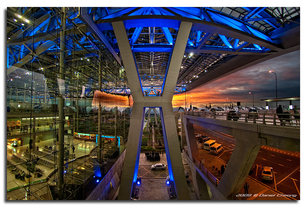
Suvarnabhumi International Airport, Bangkok, Thailand. Taken on the day of my flight back to Dubai (in the giant double decker Airbus A380 by the way! A very smooth journey in an awesome airplane).
6 exposures Digital Blending shot handheld, using my Nikkor Fisheye at f/2.8, and Auto ISO on the D300 with minimum shutter speed limited to 1/30s. Therefore the ISO for all the exposures varies from ISO 200 to 1600 (max. ISO also fixed by me), and the shutter speed never goes below 1/30s, therefore no need for a tripod in those conditions.
The manual blending with layer masks and paintbrushes was a bit tedious and it took me over 2 hours to process this shot.
Many thanks to my buddy Grant for telling me about this Auto ISO / Shutter Speed limit feature of the D300, which is really handy for handheld bracketed shots.
Thailand Set | Digital Blending Set | Architecture Set | Most Interesting shots
22 of 100 Strangers
It's been quite awhile since I captured a photo of strangers. My goal is 100, but no time limit. I have individual photos of the girls, but I really like this one. This is Ashlinn and Presli from Hudsonville. They were attending the Holland Street Performers event last night. A fellow photographer, Kevin, saw them right before I did, and photographed them first. The girls were very friendly and photographic.
Thanks for comments and favs :)
Another 'longshot' from the 100-400 those powerlines in the cutting catching the light were interesting..
Olympus OM-1 w M.Zuiko 100-400/5-6.3 IS and MC14 Tele
ISO80 f/8.7 370mm -3,-2 and 0ev
Really pushing the electronic shutter on this one -3ev = 1/32000th/sec - (I love my D/SLR but that's way beyond the mech shutter's limit)
Three frames raw developed in DxO PhotoLab 8, stacked and blended in Affinity Photo 2.6 Beta, colour graded in Nik 7 Color Efex and finished off back in PhotoLab.
Boonerah Pt to the Escarpment, Lake Illawarra, Shellharbour, NSW
El Rio Agueda nace en la Sierra de Gata en el termino municipal de Navasfrias, justo en el limite con Cáceres y Portugal. Es un excelente Río truchero en su primer curso, atraviesa toda la comarca del rebollar, al principio es un Río de aguas bravas y estrecho. Pero al llegar al termino municipal de Fuenteguinaldo se ensancha y forma los riscos de la herguijuela y Martiago que son considerados parajes de interés natural, el río atraviesa dos presas, la de Irueña (reciente construcción) y la que lleva su nombre, inaugurada en 1931.A partir de la presa del Agueda el Río comienza a entrar en terreno llano y con mucha vegetación hasta mas allá de Ciudad Rodrigo. Cerca de Ciudad Rodrigo hay un paraje llamado "el vado" una zona que en verano se llena de bañistas, debido a la extensa y frondosa vegetación que proporciona un frescor agradable en el estío.
El río a su paso por Ciudad Rodrigo también forma una amplia alameda llena de árboles y hay una zona recreativa llamada "la pesquera", también conocida como "el picon".
Hace años hubo inundaciones y riadas a su paso por Ciudad Rodrigo. Una ocurrió en 1909 y otra el 8 de Diciembre del 2000. En algunas de las riadas bajó el agua con tanta fuerza que se llevo la mitad del puente romano, y tuvieron que reconstruirlo.
En el momento que hice esta foto, el lugar era un remanso de paz y de tranquilidad, donde el paisaje bucólico invitaba al relax y la calma.
•The truth about Yosemite: www.nbcbayarea.com/news/local/Sexual-Harassment-Common-in...
It was a frosty morning along the Tuolumne River.
Photo taken with Nikon D600, Tokina 17-35 Pro FX F4 and Kenko Circular Polarizer. I took 9 images at one stop increments (RAW Format). To achieve this with the D600 I used auto-bracketing; it only takes 3 shot burst, so I set the 1st 3 at 3 stop increment, the 2nd 3 at 2 at stops, the 3rd 3 at 1 stop, to take a total of 9 images. I used a Nikon wireless shutter release to limit movement; I dropped it in the river that morning was lucky enough to snag it back out, shook it off and used it all day.
To achieve this dynamic range, color and effects: I use Lightroom 5.5 for workflow and final edit. I first used Photomatix Pro 4 to fuse all 9 images. Now using auto-bracketing I end up with 3 images with 0 stop adjustment because of the 3 shot burst. Photomatix will automatically adjust these to make all 9 images at whatever stop level you input, I set it for 1 stop increment. Once this is done I use Photmatix Fusion Preset to merge the 9 images together. It has many Presets, but this gives me the most natural effects. Once fused, I save in Tiff format to retain as much raw data as I can. I then use NIK Collection; Color Efex Pro 4. For this image I used its Pro Contrast adjustment; it improves the dynamic range and has one of the best Highlight and Shadow adjustments I’ve seen (even better than Lightroom’s). I do my final exposure, then tweak Clarity and Vibrance a bit in Lightroom 5.5 and save in jpg. My Logo (TI_in_Yosemite) is done in Gimp 2.8 and Layered onto the final image. TI_in_Yosemite stands for: Targeted Individual in Yosemite.
I took an oath to defend this Country and its Constitution. This Country has become not the one I once believed in. It has become a Country that Targets individuals, that go against the Statuesque of Corruption that’s imbedded in our Government, Corporations and Society. I will continue to serve this Country and expose those that threaten its moral fiber.
Help us bring Social Change through Photography; bring awareness and stop Gang Stalking, Community Based Stalking and Workplace Mobbing. We are trying to make these changes one community at a time. So, here is a contact page for Yosemite National Park: www.nps.gov/yose/contacts.htm. Once on this page; click on ask a question or make a comment. This is your National Park please take the time to contact them; tell them to put a stop to Gang Stalking, Community Based Stalking and Workplace Mobbing.
These immoral and illegal acts are allowed in Yosemite National Park by Law Enforcement, encouraged and performed by its Contractors. Thank you for taking the time to visit my photostream.
Fort Lauderdale is a city in the U.S. state of Florida, 28 miles (45 km) north of Miami. It is the county seat of Broward County. As of the 2010 census, the city had a population of 165,521. It is a principal city of the Miami metropolitan area, which was home to an estimated 6,012,331 people at the 2015 census.
The city is a popular tourist destination, with an average year-round temperature of 75.5 °F (24.2 °C) and 3,000 hours of sunshine per year. Greater Fort Lauderdale which takes in all of Broward County hosted 12 million visitors in 2012, including 2.8 million international visitors. The city and county in 2012 collected $43.9 million from the 5% hotel tax it charges, after hotels in the area recorded an occupancy rate for the year of 72.7 percent and an average daily rate of $114.48. The district has 561 hotels and motels comprising nearly 35,000 rooms. Forty six cruise ships sailed from Port Everglades in 2012. Greater Fort Lauderdale has over 4,000 restaurants, 63 golf courses, 12 shopping malls, 16 museums, 132 nightclubs, 278 parkland campsites, and 100 marinas housing 45,000 resident yachts.
Fort Lauderdale is named after a series of forts built by the United States during the Second Seminole War. The forts took their name from Major William Lauderdale (1782–1838), younger brother of Lieutenant Colonel James Lauderdale. William Lauderdale was the commander of the detachment of soldiers who built the first fort. However, development of the city did not begin until 50 years after the forts were abandoned at the end of the conflict. Three forts named "Fort Lauderdale" were constructed; the first was at the fork of the New River, the second at Tarpon Bend on the New River between the Colee Hammock and Rio Vista neighborhoods, and the third near the site of the Bahia Mar Marina.
The area in which the city of Fort Lauderdale would later be founded was inhabited for more than two thousand years by the Tequesta Indians. Contact with Spanish explorers in the 16th century proved disastrous for the Tequesta, as the Europeans unwittingly brought with them diseases, such as smallpox, to which the native populations possessed no resistance. For the Tequesta, disease, coupled with continuing conflict with their Calusa neighbors, contributed greatly to their decline over the next two centuries. By 1763, there were only a few Tequesta left in Florida, and most of them were evacuated to Cuba when the Spanish ceded Florida to the British in 1763, under the terms of the Treaty of Paris (1763), which ended the Seven Years' War. Although control of the area changed between Spain, United Kingdom, the United States, and the Confederate States of America, it remained largely undeveloped until the 20th century.
The Fort Lauderdale area was known as the "New River Settlement" before the 20th century. In the 1830s there were approximately 70 settlers living along the New River. William Cooley, the local Justice of the Peace, was a farmer and wrecker, who traded with the Seminole Indians. On January 6, 1836, while Cooley was leading an attempt to salvage a wrecked ship, a band of Seminoles attacked his farm, killing his wife and children, and the children's tutor. The other farms in the settlement were not attacked, but all the white residents in the area abandoned the settlement, fleeing first to the Cape Florida Lighthouse on Key Biscayne, and then to Key West.
The first United States stockade named Fort Lauderdale was built in 1838, and subsequently was a site of fighting during the Second Seminole War. The fort was abandoned in 1842, after the end of the war, and the area remained virtually unpopulated until the 1890s. It was not until Frank Stranahan arrived in the area in 1893 to operate a ferry across the New River, and the Florida East Coast Railroad's completion of a route through the area in 1896, that any organized development began. The city was incorporated in 1911, and in 1915 was designated the county seat of newly formed Broward County.
Fort Lauderdale's first major development began in the 1920s, during the Florida land boom of the 1920s. The 1926 Miami Hurricane and the Great Depression of the 1930s caused a great deal of economic dislocation. In July 1935, an African-American man named Rubin Stacy was accused of robbing a white woman at knife point. He was arrested and being transported to a Miami jail when police were run off the road by a mob. A group of 100 white men proceeded to hang Stacy from a tree near the scene of his alleged robbery. His body was riddled with some twenty bullets. The murder was subsequently used by the press in Nazi Germany to discredit US critiques of its own persecution of Jews, Communists, and Catholics.
When World War II began, Fort Lauderdale became a major US base, with a Naval Air Station to train pilots, radar operators, and fire control operators. A Coast Guard base at Port Everglades was also established.
On July 4, 1961 African Americans started a series of protests, wade-ins, at beaches that were off-limits to them, to protest "the failure of the county to build a road to the Negro beach". On July 11, 1962 a verdict by Ted Cabot went against the city's policy of racial segregation of public beaches.
Today, Fort Lauderdale is a major yachting center, one of the nation's largest tourist destinations, and the center of a metropolitan division with 1.8 million people.
Credit for the data above is given to the following website:
en.wikipedia.org/wiki/Fort_Lauderdale,_Florida
© All Rights Reserved - you may not use this image in any form without my prior permission.
Ethiopia (Abisinia), África pura
© All rights reserved. © Copyright.
Do not use my photography withaut my permision.
Viaje de 8 días por Ethiopia. Empezamos por el Norte, el desierto, la Depresión de Danakil, el lugar más caluroso del planeta, dominado por la etnia Afar, para posteriormente bajar al Sur, la sabana, verde, el Valle del Rio Omo, visitando diferentes etnias: Dorze, Konso, Dassanech y Hamer. Extenuante pero corto, muy corto.
Ethiopia (Abisinia, el Reino de Saba en la Biblia) es un lugar inhóspito y no preparado para el turismo y debes contar con una agencia que organice tu aventura (yo fui con Karibu, www.kaett.com). Ethiopia limita con países en conflicto y en los desplazamientos por el Norte, el desierto, Danakil, estarás acompañado por policía o milicianos armados, además de guía, cocinero, pinche y conductores.
Primer día, llegamos mi mujer y yo, a primeros de Mayo, época no turística debido al calor, a Addis Ababa, con Ethiopian Airlines, para enlazar con un vuelo regional a Makele. En Makele montamos en 4x4 para desplazarnos a Dallol, zona desértica con temperaturas de noche 26 y día 45ºC. Dormimos de acampada, al aire libre sobre camastros, junto con todos nuestros acompañantes, el viento y millones de estrellas. El calor, agobiante, Mayo no es el mejor mes para visitar Danakil. Antes de dormir vislumbramos las caravanas de camellos trasportando la sal depositada en el desierto al secarse un mar interior miles de años atrás. También visitamos las salinas infinitas, disfrutamos de una puesta de Sol con reflejos, única.
El segundo día visitamos la Puerta del Infierno, una zona donde la tierra expulsa compuestos de azufre continuamente y donde se han generado unos cráteres freáticos únicos en el mundo, de una extraordinaria belleza y colorido. Andábamos sobre cristales de azufre y óxidos metálicos que crujían bajo nuestros pies. Al terminar la jornada las zapatillas habían pasado a mejor vida. Siempre acompañados por un Kalashnikova AK 47. Llegar hasta allí en un 4x4 sobre las salinas infinitas, con 20 cm de agua sobre la superficie y a 10 km/h durante 2 o 3 hrs, sin llegar nunca, sin ver fondo bajo las ruedas, es uno de los muchos gratos recuerdos que nos ha proporcionado esta superaventura. Más tarde visitamos a los Afar durante su trabajo diario, cortar bloques de sal de 30x40x8 cm que se cargarán sobre los camellos para transportarlos en caravanas infinitas. Aquí todo es infinito. Trabajan bajo un Sol abrasador, pero aunque el Gobierno les ofrece mecanizar la explotación, los Afar no lo permiten, temen perder su forma de vida. Ya no sé dónde dormimos, quizás en Dodhom, donde mataron un cabrito para cenar.
El tercer día pretendíamos subir por la noche al Erta Ale, volcán activo con una caldera de magma en ebullición. Al llegar al campo base para gestionar permisos y más y más acompañantes, las temperaturas habían subido a 52ºC. Esta es la zona más caliente de la Tierra y el espesor de la corteza terrestre es el más estrecho de todos los continentes. De hecho esta es la zona del Rift, donde el cuerno de África se escindirá del continente en algunos miles de años. Estamos 110m por debajo del nivel del mar. Mi mujer sufrió un pequeño golpe de calor mientras tratábamos de comer algo a 52ºC y por prudencia descartamos subir al Arte Ale, lo dejamos, o mejor dicho, lo dejaré para un próximo viaje. Se suben 10Km andando por la noche durante unas 4 horas y se duerme en la caldera, tomando fotos del magma durante la noche, para bajar a primera hora de la mañana, antes de que el Sol abrase.. Así las cosas, decidimos volver a Makele (necesitábamos hotel y descanso) pero de camino visitamos un pequeño lago encantador, quizás el lago Bakili, junto a las salinas, dado que el cambio de planes no nos permitiría ya visitar el Lago Afdera de aguas color esmeralda.
El cuarto día, improvisando, desde Makele hicimos una visita a una de las miles iglesias en Ethiopia excavadas en la roca, donde el prior nos abrió y atendió con sumo cariño, y posteriormente visitamos la Misión del Padre Ángel, amigo Vasco que realiza una labor extraordinaria en la zona. El Padre Ángel (www. Angelolaran.com) aparenta muchos más años de los que tiene, eso es debido sin duda a una larga vida de sufrimiento. Nos invitó a comer en la misión pero tuvimos que descartarlo para volver a Makele y tomar vuelo a Addis Ababa, también queda pendiente para un próximo viaje. A la vuelta enviamos un donativo a la Misión, ese país y Ángel necesitan de toda nuestra ayuda.
Quinto día, desde Addis Ababa tomamos un 4x4 para desplazarnos hacia el Sur, rico en Etnias, poblados, tribus, que nos iban a enamorar. Ni que decir tiene que a estas alturas ya me había convertido en un maestro de la fotografía en desplazamiento, a 80 Km/h en 4x4 se obtienen, a 1/2000s, unas fotografías impagables, las carreteras están llenas de vida y de color. Por la tarde llegamos a Arba Minch, donde habitan los Dorze, a una cota de 3.200m , en sus casas de bambú. Las chozas, de unos 40m2 pueden incluso transportarse con ayuda de 60 personas cuando las termitas se comen la base de sus troncos. Tienen la apariencia de la cabeza de un elefante. Esa noche dormimos en el Paradise Lodge, recomendable, en una cabaña con vistas a los lagos Abaya y Chamo. Estábamos muertos, no hice fotos de la vía láctea y no me lo perdonaré nunca, pero conseguí unos amaneceres únicos.
Sexto día, de nuevo en 4x4 y 1/2000s. Nos desplazamos a las tierras altas donde habita la Etnia Konso, en el rio Segen. Los Konso son la tribu más organizada y han sido reconocidos como Patrimonio de la Humanidad por Unesco. Un ejemplo, la piedra de la verdad, donde ante el Consejo del Pueblo ningún vecino se atrevería a mentir influenciado por un temor ancestral a sufrir los peores males como consecuencia de mentir mientras se está de pie sobre esa piedra. La visita a su poblado es indescriptible, una sociedad muy avanzada con un nivel jerárquico bien asumido y una socialización envidiable. Después, desplazamiento a la zona de Turmi, donde empezamos a cruzarnos con los Hamer, pintados con barro en el pelo y acompañados de collares de conchas. Dormimos en el Busca Lodge, con generador eléctrico que arranca de 6 a 9, eso sí, por la mañana y por la noche.
Séptimo día, cruzando el rio Omo en piragua (tronco de árbol vaciado) para visitar a los nómadas Dassanech. ¡Qué encanto!. Nos recibieron con sus bailes y pasamos la mañana de su mano, sí, nos llevaban de la mano mientras nos enseñaban su poblado. Sus poblados se caracterizan por el uso de chapa de lata para cubrir sus chozas, ese material que les han traído los Dioses les permite que la vida de su choza se alargue por varios años, además de mantenerlas secas, maravillas de la tecnología. Unos globos y caramelos son el regalo más apreciado por los niños. Por la tarde visita al mercado de Turmi, donde los Hamer y otras tribus se dan cita para intercambiar sus productos (grano, ganado, madera trabajada,...). Más tarde, casi a la puesta de Sol visitamos un poblado Hamer. De chozas con vallado para los animales. Igual de encantadores que los Dassenech, solo nos atendieron los niños, los adultos vienen andando desde el mercado de Turmi. Los niños te piden 5 Birs por cada foto que les haces (íbamos armados con fajos de billetes de 5, claro), el capitalismo está llegando para quedarse. Sonrisas y bromas continuamente, inolvidable. De nuevo al hotel con acotado horario para la ducha.
Octavo día, 4x4 a Arba Minch y vuelo regional a Addis Ababa, con shopping y cena étnica para tomar vuelo de nuevo para Madrid (Ida y vuelta nocturna).
Algún bajón de tensión, golpes de calor, catarros por el A/A del 4x4, diarrea (posiblemente el contacto con los billetes viejos contaminados con todo tipo de gérmenes), pero desde ya, contando ansioso los días que faltan para volver de nuevo. Bendita África pura.
380 imágenes para enmarcar y el 24-120mm muerto, no enfoca, directamente a Nikon...
Ethiopia (Abisinia), África pura
© All rights reserved. © Copyright.
Do not use my photography withaut my permision.
Viaje de 8 días por Ethiopia. Empezamos por el Norte, el desierto, la Depresión de Danakil, el lugar más caluroso del planeta, dominado por la etnia Afar, para posteriormente bajar al Sur, la sabana, verde, el Valle del Rio Omo, visitando diferentes etnias: Dorze, Konso, Dassanech y Hamer. Extenuante pero corto, muy corto.
Ethiopia (Abisinia, el Reino de Saba en la Biblia) es un lugar inhóspito y no preparado para el turismo y debes contar con una agencia que organice tu aventura (yo fui con Karibu, www.kaett.com). Ethiopia limita con países en conflicto y en los desplazamientos por el Norte, el desierto, Danakil, estarás acompañado por policía o milicianos armados, además de guía, cocinero, pinche y conductores.
Primer día, llegamos mi mujer y yo, a primeros de Mayo, época no turística debido al calor, a Addis Ababa, con Ethiopian Airlines, para enlazar con un vuelo regional a Makele. En Makele montamos en 4x4 para desplazarnos a Dallol, zona desértica con temperaturas de noche 26 y día 45ºC. Dormimos de acampada, al aire libre sobre camastros, junto con todos nuestros acompañantes, el viento y millones de estrellas. El calor, agobiante, Mayo no es el mejor mes para visitar Danakil. Antes de dormir vislumbramos las caravanas de camellos trasportando la sal depositada en el desierto al secarse un mar interior miles de años atrás. También visitamos las salinas infinitas, disfrutamos de una puesta de Sol con reflejos, única.
El segundo día visitamos la Puerta del Infierno, una zona donde la tierra expulsa compuestos de azufre continuamente y donde se han generado unos cráteres freáticos únicos en el mundo, de una extraordinaria belleza y colorido. Andábamos sobre cristales de azufre y óxidos metálicos que crujían bajo nuestros pies. Al terminar la jornada las zapatillas habían pasado a mejor vida. Siempre acompañados por un Kalashnikova AK 47. Llegar hasta allí en un 4x4 sobre las salinas infinitas, con 20 cm de agua sobre la superficie y a 10 km/h durante 2 o 3 hrs, sin llegar nunca, sin ver fondo bajo las ruedas, es uno de los muchos gratos recuerdos que nos ha proporcionado esta superaventura. Más tarde visitamos a los Afar durante su trabajo diario, cortar bloques de sal de 30x40x8 cm que se cargarán sobre los camellos para transportarlos en caravanas infinitas. Aquí todo es infinito. Trabajan bajo un Sol abrasador, pero aunque el Gobierno les ofrece mecanizar la explotación, los Afar no lo permiten, temen perder su forma de vida. Ya no sé dónde dormimos, quizás en Dodhom, donde mataron un cabrito para cenar.
El tercer día pretendíamos subir por la noche al Erta Ale, volcán activo con una caldera de magma en ebullición. Al llegar al campo base para gestionar permisos y más y más acompañantes, las temperaturas habían subido a 52ºC. Esta es la zona más caliente de la Tierra y el espesor de la corteza terrestre es el más estrecho de todos los continentes. De hecho esta es la zona del Rift, donde el cuerno de África se escindirá del continente en algunos miles de años. Estamos 110m por debajo del nivel del mar. Mi mujer sufrió un pequeño golpe de calor mientras tratábamos de comer algo a 52ºC y por prudencia descartamos subir al Arte Ale, lo dejamos, o mejor dicho, lo dejaré para un próximo viaje. Se suben 10Km andando por la noche durante unas 4 horas y se duerme en la caldera, tomando fotos del magma durante la noche, para bajar a primera hora de la mañana, antes de que el Sol abrase.. Así las cosas, decidimos volver a Makele (necesitábamos hotel y descanso) pero de camino visitamos un pequeño lago encantador, quizás el lago Bakili, junto a las salinas, dado que el cambio de planes no nos permitiría ya visitar el Lago Afdera de aguas color esmeralda.
El cuarto día, improvisando, desde Makele hicimos una visita a una de las miles iglesias en Ethiopia excavadas en la roca, donde el prior nos abrió y atendió con sumo cariño, y posteriormente visitamos la Misión del Padre Ángel, amigo Vasco que realiza una labor extraordinaria en la zona. El Padre Ángel (www. Angelolaran.com) aparenta muchos más años de los que tiene, eso es debido sin duda a una larga vida de sufrimiento. Nos invitó a comer en la misión pero tuvimos que descartarlo para volver a Makele y tomar vuelo a Addis Ababa, también queda pendiente para un próximo viaje. A la vuelta enviamos un donativo a la Misión, ese país y Ángel necesitan de toda nuestra ayuda.
Quinto día, desde Addis Ababa tomamos un 4x4 para desplazarnos hacia el Sur, rico en Etnias, poblados, tribus, que nos iban a enamorar. Ni que decir tiene que a estas alturas ya me había convertido en un maestro de la fotografía en desplazamiento, a 80 Km/h en 4x4 se obtienen, a 1/2000s, unas fotografías impagables, las carreteras están llenas de vida y de color. Por la tarde llegamos a Arba Minch, donde habitan los Dorze, a una cota de 3.200m , en sus casas de bambú. Las chozas, de unos 40m2 pueden incluso transportarse con ayuda de 60 personas cuando las termitas se comen la base de sus troncos. Tienen la apariencia de la cabeza de un elefante. Esa noche dormimos en el Paradise Lodge, recomendable, en una cabaña con vistas a los lagos Abaya y Chamo. Estábamos muertos, no hice fotos de la vía láctea y no me lo perdonaré nunca, pero conseguí unos amaneceres únicos.
Sexto día, de nuevo en 4x4 y 1/2000s. Nos desplazamos a las tierras altas donde habita la Etnia Konso, en el rio Segen. Los Konso son la tribu más organizada y han sido reconocidos como Patrimonio de la Humanidad por Unesco. Un ejemplo, la piedra de la verdad, donde ante el Consejo del Pueblo ningún vecino se atrevería a mentir influenciado por un temor ancestral a sufrir los peores males como consecuencia de mentir mientras se está de pie sobre esa piedra. La visita a su poblado es indescriptible, una sociedad muy avanzada con un nivel jerárquico bien asumido y una socialización envidiable. Después, desplazamiento a la zona de Turmi, donde empezamos a cruzarnos con los Hamer, pintados con barro en el pelo y acompañados de collares de conchas. Dormimos en el Busca Lodge, con generador eléctrico que arranca de 6 a 9, eso sí, por la mañana y por la noche.
Séptimo día, cruzando el rio Omo en piragua (tronco de árbol vaciado) para visitar a los nómadas Dassanech. ¡Qué encanto!. Nos recibieron con sus bailes y pasamos la mañana de su mano, sí, nos llevaban de la mano mientras nos enseñaban su poblado. Sus poblados se caracterizan por el uso de chapa de lata para cubrir sus chozas, ese material que les han traído los Dioses les permite que la vida de su choza se alargue por varios años, además de mantenerlas secas, maravillas de la tecnología. Unos globos y caramelos son el regalo más apreciado por los niños. Por la tarde visita al mercado de Turmi, donde los Hamer y otras tribus se dan cita para intercambiar sus productos (grano, ganado, madera trabajada,...). Más tarde, casi a la puesta de Sol visitamos un poblado Hamer. De chozas con vallado para los animales. Igual de encantadores que los Dassenech, solo nos atendieron los niños, los adultos vienen andando desde el mercado de Turmi. Los niños te piden 5 Birs por cada foto que les haces (íbamos armados con fajos de billetes de 5, claro), el capitalismo está llegando para quedarse. Sonrisas y bromas continuamente, inolvidable. De nuevo al hotel con acotado horario para la ducha.
Octavo día, 4x4 a Arba Minch y vuelo regional a Addis Ababa, con shopping y cena étnica para tomar vuelo de nuevo para Madrid (Ida y vuelta nocturna).
Algún bajón de tensión, golpes de calor, catarros por el A/A del 4x4, diarrea (posiblemente el contacto con los billetes viejos contaminados con todo tipo de gérmenes), pero desde ya, contando ansioso los días que faltan para volver de nuevo. Bendita África pura.
380 imágenes para enmarcar y el 24-120mm muerto, no enfoca, directamente a Nikon...
After an afternoon layover in Jim Thorpe, T-1 #2102 exits the yard limits at Jim Thorpe Jct. headed back for Reading.
SN/NC: Gustavia Augusta Syn. Gustavia Hexapetala, Gustavia Superba, Lecythidaceae Family
Gustavia augusta is an evergreen tree with a small, pyramid-shaped crown; it can grow 6-10 metres tall. The short, usually crooked bole can be 20-30cm in diameter.
The tree is sometimes harvested from the wild for local use as a medicine and source of wood. A very ornamental small tree, valued particularly for its delicate, fragrant flowers, it is used in landscaping in parts of Brazil.
They are found in S. America - northern Brazil, Bolivia,Peru, Colombia, Venezuela, the Guyanas.
An understorey tree in the rainforest, favouring loamy, rocky or sandy soils. Usually found in areas not subject to inundation, but grows taller in areas where there is seasonal inundation. Mainly in the primary forest, occasionally in open areas
Grows best in the shade of other trees. A slow-growing tree, barely reaching a height of 1.5 metres after 2 years. Plants can flower all year round.
The Gustavia augusta is used in the folk medicine against leishmaniosis and showed anti-inflammatory action.
Nome científico: Gustavia augusta L.
Família: Lecythidaceae
Nomes populares: Pau-fedorento, geniperana, jeniparana, jandiparana, janiparandiba,japaranduba, japuaranduba, general, mucurão, membrillo.
Origem: América do Sul.
Distribuição geográfica: Região norte e nordeste do Brasil.
Altura média: 6-10m
Características morfológicas: O caule, quando cortado, tem odor desagradável, daí vem onome popular pau-fedorento. As folhas são grandes e a inflorescência terminal nos ramos, com 1-8 flores grandes, perfumadas, branco-róseas; frutos globosos, com polpa amarelada quando maduros e 2-20 sementes.
Utilidades econômicas: Como ornamental e na arborização. A casca serve para o curtimento de couros. A madeira pode ser usada em construção. E a polpa dos frutos é comestível. Por isso em espanhol a chamam de "marmelada". Os frutos são avidamente consumidos pelos roedores em geral, esquilos e macacos em particular, além de morcegos que junto com as abelhas fazem a polinização das flores.
Propriedades medicinais: É laxante, antioxidante e descongestionante.
Características interessantes: As flores são visitadas por abelhas, borboletas e pássaros. Macacos conseguem abrir os frutos e comer sua polpa e sementes. São elementos chaves na dispersão e reprodução da espécie.
Gustavia augusta is een groenblijvende boom met een kleine, piramidevormige kroon; hij kan 6-10 meter hoog worden. De korte, meestal kromme stam kan 20-30 cm in diameter zijn.
De boom wordt soms uit het wild geoogst voor lokaal gebruik als medicijn en bron van hout. Een zeer decoratieve kleine boom, vooral gewaardeerd om zijn delicate, geurige bloemen, hij wordt gebruikt in landschapsarchitectuur in delen van Brazilië.
Ze zijn te vinden in Zuid-Amerika - Noord-Brazilië, Bolivia, Peru, Colombia, Venezuela, de Guyana's.
Een ondergroei boom in het regenwoud, die de voorkeur geeft aan leemachtige, rotsachtige of zanderige bodems. Meestal te vinden in gebieden die niet onderhevig zijn aan overstroming, maar groeit groter in gebieden met seizoensgebonden overstroming. Voornamelijk in het primaire bos, af en toe in open gebieden
Groeit het beste in de schaduw van andere bomen. Een langzaam groeiende boom die na 2 jaar amper 1,5 meter hoog wordt. Planten kunnen het hele jaar door bloeien.
De Gustavia augusta wordt gebruikt in de volksgeneeskunde tegen leishmaniose en heeft een ontstekingsremmende werking.
Gustavia augusta ist ein immergrüner Baum mit einer kleinen pyramidenförmigen Krone; es kann 6-10 Meter hoch werden. Der kurze, normalerweise krumme Baumstamm kann einen Durchmesser von 20 bis 30 cm haben.
Der Baum wird manchmal in freier Wildbahn für die lokale Verwendung als Medizin und Holzquelle geerntet. Ein sehr dekorativer kleiner Baum, der besonders für seine zarten, duftenden Blüten geschätzt wird und in Teilen Brasiliens für die Landschaftsgestaltung verwendet wird.
Sie kommen in Südamerika vor - Nordbrasilien, Bolivien, Peru, Kolumbien, Venezuela, den Guyanas.
Ein unterirdischer Baum im Regenwald, der lehmige, felsige oder sandige Böden bevorzugt. Wird normalerweise in Gebieten gefunden, die keiner Überschwemmung ausgesetzt sind, wächst jedoch in Gebieten mit saisonaler Überschwemmung höher. Hauptsächlich im Primärwald, gelegentlich in offenen Gebieten
Wächst am besten im Schatten anderer Bäume. Ein langsam wachsender Baum, der nach 2 Jahren kaum eine Höhe von 1,5 Metern erreicht. Pflanzen können das ganze Jahr über blühen.
Die Gustavia augusta wird in der Volksmedizin gegen Leishmaniose eingesetzt und zeigte entzündungshemmende Wirkung.
Gustavia augusta est un arbre à feuilles persistantes avec une petite couronne en forme de pyramide; il peut atteindre une hauteur de 6 à 10 mètres. Le fût court, généralement tordu, peut mesurer entre 20 et 30 cm de diamètre.
L'arbre est parfois récolté dans la nature pour un usage local comme médicament et source de bois. Petit arbre très ornemental, apprécié particulièrement pour ses fleurs délicates et parfumées, il est utilisé dans l'aménagement paysager dans certaines régions du Brésil.
On les trouve en Amérique du Sud - nord du Brésil, Bolivie, Pérou, Colombie, Venezuela, Guyanes.
Un arbre de sous-étage dans la forêt tropicale, privilégiant les sols limoneux, rocheux ou sableux. Habituellement trouvé dans les zones non sujettes aux inondations, mais pousse plus haut dans les zones où il y a des inondations saisonnières. Principalement dans la forêt primaire, parfois dans des zones ouvertes
Pousse mieux à l'ombre des autres arbres. Un arbre à croissance lente, atteignant à peine une hauteur de 1,5 mètre après 2 ans. Les plantes peuvent fleurir toute l'année.
Le Gustavia augusta est utilisé dans la médecine traditionnelle contre la leishmaniose et a montré une action anti-inflammatoire.
La especie es originaria de Panamá, Colombia y Ecuadordonde vive en las forestas húmedas, representando en algunas zonas la especiedominante, en bajas altitudes.
El género ha sido dedicado porLinneo al rey Gustavo III de Suecia (1746-1792) su mecenas; el nombre de la especie es el adjetivo latino "superbus, a, um" = soberbio, magnífico, con obvia referencia.
Nombres comunes: heaven lotus, monkey fruit (inglés); membrillo, membrillo hembra, pacó, pacora, sachamango (español).
La Gustavia superba (Kunth)O.Berg (1856) es un árbol siempre verde poco ramificado con tronco erecto de corteza grisácea, de 5-10 m de altura y 10-20 cm de diámetro.
Las hojas, sobre un corto pecíolo, son simples, alternas,coriáceas, concentradas en los ápices de las ramas, de forma oblongo-oblanceolada con ápice bruscamente puntiagudo, largas hasta 0,8-1 m y anchas 25 cm con márgen ligeramente dentado, glabras, de color bronce en las hojas jóvenes,luego verde oscuro.
Inflorescencia en cortos corimbos directamente desde eltronco o desde las ramas principales llevando pocas flores, sobre un pedicelolargo cerca 8 cm, de 12-15 cm de diámetro, con 6-10 pétalos desigualesobovados, de 5-6 cm de largo y 3,5 cm de ancho, de color de blanco a blanco crema a veces esfumado con rosa púrpura, y numerosos estambres, rosados superiormente, largos cerca 4 cm, fusionados por un tercio de su largo formando un anillo carnoso amarillento: las flores son polinizadas por las abejas y los murciélagos.
El fruto es una píxide (fruto seco en el que en la madurez se despega superiormente una suerte de tapa, llamada opérculo) globosa-deprimida con un anillo prominente en el ápice, larga cerca 8 cm y ancha hasta 10 cm, verde tendiendo al amarillo y naranja, a menudo de olor bastante desagradable en su madurez, conteniendo aproximadamente 7 semillas de color marrón y de forma irregular, largas 1-4 cm, con arillo carnoso naranja comestible. Los frutos son un alimento para los primates, en particular Cebuscapucinus (Linnaeus, 1758), conejos, roedores, ardillas y otros pequeños animales que contribuyen a la dispersión de las semillas.
Se reproduce fácilmente por semilla, sumergida en agua por un día, en sustrato orgánico con agregado de arena silícea o perlita en un 30% mantenido húmedo a 24-26 ºC de temperatura con tiempos de germinación de 7-9 semanas, o por esqueje.
Especie de grandísimo valor ornamental, por el follaje y sobre todo por sus grandes flores, difundida en las zonas de origen, donde escultivada a menudo en los jardines familiares por sus frutos, pero poco conocida en otros lugares.
Cultivable en las zonas de clima tropical y subtropical húmedo sobre suelos bien drenados ricos en sustancia orgánica, ácidos o neutros, mantenidos constantemente húmedos, pero sin encharcamientos, en pleno sol o ligera sombra y al reparo de los vientos.
Donde el clima no consiente la permanencia al aire libre durante los meses invernales puede ser cultivada en contenedores grandes, donde puede también florecer, para ser reparada en invernaderos o jardines de invierno espaciosos y luminosos, utilizando un sustrato orgánico con agregadode arena silícea o perlita en un 30% para mejorar el drenaje; ya sea la humedad ambiental que las temperaturas deben ser altas, con valores mínimos para éstas no inferiores a 15 ºC. Los riegos deben ser regulares en verano, más distanciadas en invierno, pero sin dejar secar completamente el sustrato.
Las fertilizaciones, durante el período vegetativo, se efectuarán preferiblemente con productos balanceados de lenta disolución con agregado de micro-elementos.
El arillo que circunda a las semillas, nutriente y con elevado contenido de grasas, fósforo y vitamina A, es consumido crudo o más frecuentemente agregado a varios platos (arroz, sopas, carnes, etc.) a los que les confiere un color y un sabor particular.
La madera tiene discretas características de dureza,resistencia y laborabilidad, y tiene una limitada utilización en las construcciones.
Fort Lauderdale is a city in the U.S. state of Florida, 25 miles (40 km) north of Miami. It is the county seat of Broward County. As of the 2019 census, the city has an estimated population of 182,437. Fort Lauderdale is a principal city of the Miami metropolitan area, which was home to an estimated 6,198,782 people in 2018.
The city is a popular tourist destination, with an average year-round temperature of 75.5 °F (24.2 °C) and 3,000 hours of sunshine per year. Greater Fort Lauderdale which takes in all of Broward County hosted 12 million visitors in 2012, including 2.8 million international visitors. The city and county in 2012 collected $43.9 million from the 5% hotel tax it charges, after hotels in the area recorded an occupancy rate for the year of 72.7 percent and an average daily rate of $114.48. The district has 561 hotels and motels comprising nearly 35,000 rooms. Forty six cruise ships sailed from Port Everglades in 2012. Greater Fort Lauderdale has over 4,000 restaurants, 63 golf courses, 12 shopping malls, 16 museums, 132 nightclubs, 278 parkland campsites, and 100 marinas housing 45,000 resident yachts.
Fort Lauderdale is named after a series of forts built by the United States during the Second Seminole War. The forts took their name from Major William Lauderdale (1782–1838), younger brother of Lieutenant Colonel James Lauderdale. William Lauderdale was the commander of the detachment of soldiers who built the first fort. However, development of the city did not begin until 50 years after the forts were abandoned at the end of the conflict. Three forts named "Fort Lauderdale" were constructed; the first was at the fork of the New River, the second at Tarpon Bend on the New River between the Colee Hammock and Rio Vista neighborhoods, and the third near the site of the Bahia Mar Marina.
The area in which the city of Fort Lauderdale would later be founded was inhabited for more than two thousand years by the Tequesta Indians. Contact with Spanish explorers in the 16th century proved disastrous for the Tequesta, as the Europeans unwittingly brought with them diseases, such as smallpox, to which the native populations possessed no resistance. For the Tequesta, disease, coupled with continuing conflict with their Calusa neighbors, contributed greatly to their decline over the next two centuries. By 1763, there were only a few Tequesta left in Florida, and most of them were evacuated to Cuba when the Spanish ceded Florida to the British in 1763, under the terms of the Treaty of Paris (1763), which ended the Seven Years' War. Although control of the area changed between Spain, United Kingdom, the United States, and the Confederate States of America, it remained largely undeveloped until the 20th century.
The Fort Lauderdale area was known as the "New River Settlement" before the 20th century. In the 1830s there were approximately 70 settlers living along the New River. William Cooley, the local Justice of the Peace, was a farmer and wrecker, who traded with the Seminole Indians. On January 6, 1836, while Cooley was leading an attempt to salvage a wrecked ship, a band of Seminoles attacked his farm, killing his wife and children, and the children's tutor. The other farms in the settlement were not attacked, but all the white residents in the area abandoned the settlement, fleeing first to the Cape Florida Lighthouse on Key Biscayne, and then to Key West.
The first United States stockade named Fort Lauderdale was built in 1838, and subsequently was a site of fighting during the Second Seminole War. The fort was abandoned in 1842, after the end of the war, and the area remained virtually unpopulated until the 1890s. It was not until Frank Stranahan arrived in the area in 1893 to operate a ferry across the New River, and the Florida East Coast Railroad's completion of a route through the area in 1896, that any organized development began. The city was incorporated in 1911, and in 1915 was designated the county seat of newly formed Broward County.
Fort Lauderdale's first major development began in the 1920s, during the Florida land boom of the 1920s. The 1926 Miami Hurricane and the Great Depression of the 1930s caused a great deal of economic dislocation. In July 1935, an African-American man named Rubin Stacy was accused of robbing a white woman at knife point. He was arrested and being transported to a Miami jail when police were run off the road by a mob. A group of 100 white men proceeded to hang Stacy from a tree near the scene of his alleged robbery. His body was riddled with some twenty bullets. The murder was subsequently used by the press in Nazi Germany to discredit US critiques of its own persecution of Jews, Communists, and Catholics.
When World War II began, Fort Lauderdale became a major US base, with a Naval Air Station to train pilots, radar operators, and fire control, operators. A Coast Guard base at Port Everglades was also established.
On July 4, 1961, African Americans started a series of protests, wade-ins, at beaches that were off-limits to them, to protest "the failure of the county to build a road to the Negro beach". On July 11, 1962, a verdict by Ted Cabot went against the city's policy of racial segregation of public beaches.
Today, Fort Lauderdale is a major yachting center, one of the nation's largest tourist destinations, and the center of a metropolitan division with 1.8 million people.
Credit for the data above is given to the following website:
en.wikipedia.org/wiki/Fort_Lauderdale,_Florida
© All Rights Reserved - you may not use this image in any form without my prior permission.
Tenía muchas ganas de hacer una fotografía nocturna donde no hubiera sombras fantasma o luces de farolas sobre la caravana, así que ahora que estoy acampado en la parcela de un amigo en mitad del campo, era el momento.
Seguramente podría haberle sacado más partido, pero entre que no veo muy bien en la oscuridad y que el riego automático del jardín ha empezado a funcionar a mitad de la sesión (😂😂😂), me he limitado a perfeccionar sólo este encuadre.
Quien sabe, quizás algún día consiga mi deseo de fotografiar la vía láctea sobre el techo de la caravana... Entretanto, esta me ha gustado.
La iluminación exterior es una lámpara solar que tiene varios modos de color. Yo he elegido el rojo para contrastar con las luces LED de dentro, que esta noche las puse en azul turquesa.
_______________________
Nikon D500
Nikkor 24-70 mm f/2.8 E ED AF-S VR
© Todos los derechos reservados. Por favor, no use esta imagen en su web, blogs u otros medios sin mi permiso explícito.
© All rights reserved. Please do not use this image on websites, blogs or other media without my explicit permission.
© Tous droits réservés. S.V.P ne pas utiliser cette photo sur un site web, blog ou tout autre média sans ma permission explicite.
bighugelabs.com/scout.php?mode=history&id=22807611586
on Explore
Exif data
Camera
Canon PowerShot SX60 HS
Exposure P
Canon Exposure Mode
Program AE
0.005 sec (1/200)
Aperture
f/5.0
Digital Zoom Ratio
2.028169014
Focal Length
14.8 mm + 2.0x converter
aka 150 mm
ISO Speed
500
Exposure Bias
-1/3 EV
#
Highest position: 498 on Saturday, November 7, 2015
#
THE RISE OF CYBORG CULTURE OR THE BOMB WAS A CYBORG
Bruce Sterling's science fiction novels portray the cyborg future of humanity. There, centuries from now, humans have divided themselves into competitive factions based on two opposing philosophies: "Mechanism" and "Shaping." The former have designed their own ontogenetic evolution through the cultivation of various technologies, including the prosthetic, mechanical, and especially cybernetic ones. The Shapers rely only on biology, biochemistry, and especially molecular biology (genetics) to "shape" themselves and their own futures, primarily by extending life, sexual potency, and certain biological talents. From back here in their past, we can perceive a certain irony (out of which Sterling makes some nice satiric hay): the two human factions are really twins, seeking a shared posthuman future, though through different means. Both evolve towards artificially constructed beings who rely merely on two different arrangements of cyborg techniques to distinguish themselves from each other. The Shapers may well pride themselves on their eugencially-selected intelligence and despise the artificial computer implants and enhancements of their Mechanist doppelgangers. Yet, as one of the Mechanist spokesmen notes, "[The Shapers] might properly be defined as industrial artifacts."[1] The Mechanists may well use software implants and direct linking to computers to enhance their faculties, and abhor the messy fecundity and (what they view as "corruption") of Shaper life, but there is no denying that their mechanical prostheses change biological facts.
In one particular epoch of Sterling's future history (which he plays out over several works of fiction), this galaxial civilization is in its decadence, verging on the apocalyptic, dangerously close to achieving a critical mass or catastrophic fluctuation that will force it to "leap to a new order of complexity" (in terms Sterling borrows from chaos theory).[2] This new order will be the Post/pp. 5-6/ human. The speeches of many characters refer to this yearned-for future; they chide each other with gibes like, "Oh, show a little Posthuman fluidity." Sterling's hero in "The Cicada Queen" foresees the shape of the posthuman in "The Lobsters," humans who have already gone over to the far side of this utopian vision. The Lobsters have "shucked their humanity like a caul," combining some Shaper bioengineering with Mechanist tech to encase themselves in completely cyberneticized shells, after altering their biology to ensure they can survive.
The Lobsters hooked into fluidic computers or sheltered themselves from solar storms and ring-system electrofluxes.
They never ate. They never drank. Sex involved a clever cyber-stimulation through cranial plugs. Every five years or so they `molted' and had their skins scraped clean of the stinking accumulation of mutated bacteria that scummed them over in the stagnant warmth [of their suits].
They knew no fear… They were self-contained and anarchical. Their greatest pleasure was to sit along a girder [on a space station] and open their amplified senses to the depths of space, watching stars past the limits of ultraviolet and infrared…
There was nothing evil about them, but they were not human. As distant and icy as comets, they were creatures of the vacuum, bored with the outmoded paradigms of blood and bone. I saw within them the first stirrings of the Fifth Prigoginic Leap… as far beyond intel-/pp. 6-7/ ligence as intelligence is from amoebic life or life from inert matter. ("Cicada Queen" 77)
I find this description of one of humanity's possible futures compelling, not so much because it is attractive (which it is in some zoned-out fashion) but simply because it seems plausible. This image of the cyborg and others, also more or less plausible, have now come to dominate our postmodern landscape, expressed in literature, film, and the arts, giving rise to rich expressions too broad and numerous to catalog here.
Today, from a vantage point after the Cold War is purportedly over, it is easier to see the outline of cyborg epistemology as it grows out of seeds engineered in World War II and blossoms in Cold War culture. - From this advantageous perspective in 1993, the contest among nations and ideologies that was World War II masked an even more important war between opposing cognitive faiths, with a definite victory for cybernetic fundamentalism. In short, to understand how and why the cyborg has achieved such predominance in the 1990s, such mythological force, we must re-read World War II and the Cold War. In this paper, I hope to show how the Mechanists, the Shapers, and the Lobsters of Sterling's imagination came to be thinkable -- if not inevitable -- versions of the posthuman because of the technologies and epistemologies that won World War II.
The "Atomic Age" vs. the "Cybernetic Age": The Bomb was a Cyborg
What would happen if you asked most contemporary commentators of the period of the late 1940s and the early 1950s: What is the single most important feature of your cultural and political landscape? or, What is the largest threat to civilization? They would undoubtedly reply to both questions, "The Bomb." It is a cliché to say that what determined the politics, much of the imaginative culture, some of the nihilistic philosophy, and certainly the Byzantine dance between the superpowers USSR and /pp. 7-8/ USA, was the threat of detonating the apocalyptic, doomsday device known first as the Atomic Bomb and later as the Nuclear Bomb. This was so true that it is also a cliché to call the Cold War Era the Atomic Age, sometimes striking an upbeat note, ringing within it the gleaming promise of a utopian future, but more often echoing something bleak and foreboding. Certainly, the popular culture of the 1950s and 1960s reflected darker images in hundreds of novels and movies about atomic bombs, monsters created by nuclear fallout, like Godzilla, and parables about post-Nuclear apocalyptic worlds like "On the Beach" and "FailSafe."
I would argue, however, that the politics of the atomic bomb and nuclear weaponry is really a small subset of a much more profound and important movement, one that is now beginning to express itself in its full-blooded manifestation. Furthermore, this movement was at its core an epistemological revolution. Why does the atomic bomb fade as an icon in the 1980s and 1990s, even while nuclear weapons stockpiles increase and proliferate, to be replaced by the computer, the AI, the robot, the cyborg as the most important icon of our generation? The answer, again, is epistemological: the Atomic Bomb was a very explosive technological device, but as such was merely a symptom or manifestation of the very same epistemology that is more fundamentally represented by the cyborg.
David Porush
Rensselaer Polytechnic Institute
from : pum.umontreal.ca
Fort Lauderdale is a city in the U.S. state of Florida, 28 miles (45 km) north of Miami. It is the county seat of Broward County. As of the 2010 census, the city had a population of 165,521. It is a principal city of the Miami metropolitan area, which was home to an estimated 6,012,331 people at the 2015 census.
The city is a popular tourist destination, with an average year-round temperature of 75.5 °F (24.2 °C) and 3,000 hours of sunshine per year. Greater Fort Lauderdale which takes in all of Broward County hosted 12 million visitors in 2012, including 2.8 million international visitors. The city and county in 2012 collected $43.9 million from the 5% hotel tax it charges, after hotels in the area recorded an occupancy rate for the year of 72.7 percent and an average daily rate of $114.48. The district has 561 hotels and motels comprising nearly 35,000 rooms. Forty six cruise ships sailed from Port Everglades in 2012. Greater Fort Lauderdale has over 4,000 restaurants, 63 golf courses, 12 shopping malls, 16 museums, 132 nightclubs, 278 parkland campsites, and 100 marinas housing 45,000 resident yachts.
Fort Lauderdale is named after a series of forts built by the United States during the Second Seminole War. The forts took their name from Major William Lauderdale (1782–1838), younger brother of Lieutenant Colonel James Lauderdale. William Lauderdale was the commander of the detachment of soldiers who built the first fort. However, development of the city did not begin until 50 years after the forts were abandoned at the end of the conflict. Three forts named "Fort Lauderdale" were constructed; the first was at the fork of the New River, the second at Tarpon Bend on the New River between the Colee Hammock and Rio Vista neighborhoods, and the third near the site of the Bahia Mar Marina.
The area in which the city of Fort Lauderdale would later be founded was inhabited for more than two thousand years by the Tequesta Indians. Contact with Spanish explorers in the 16th century proved disastrous for the Tequesta, as the Europeans unwittingly brought with them diseases, such as smallpox, to which the native populations possessed no resistance. For the Tequesta, disease, coupled with continuing conflict with their Calusa neighbors, contributed greatly to their decline over the next two centuries. By 1763, there were only a few Tequesta left in Florida, and most of them were evacuated to Cuba when the Spanish ceded Florida to the British in 1763, under the terms of the Treaty of Paris (1763), which ended the Seven Years' War. Although control of the area changed between Spain, United Kingdom, the United States, and the Confederate States of America, it remained largely undeveloped until the 20th century.
The Fort Lauderdale area was known as the "New River Settlement" before the 20th century. In the 1830s there were approximately 70 settlers living along the New River. William Cooley, the local Justice of the Peace, was a farmer and wrecker, who traded with the Seminole Indians. On January 6, 1836, while Cooley was leading an attempt to salvage a wrecked ship, a band of Seminoles attacked his farm, killing his wife and children, and the children's tutor. The other farms in the settlement were not attacked, but all the white residents in the area abandoned the settlement, fleeing first to the Cape Florida Lighthouse on Key Biscayne, and then to Key West.
The first United States stockade named Fort Lauderdale was built in 1838, and subsequently was a site of fighting during the Second Seminole War. The fort was abandoned in 1842, after the end of the war, and the area remained virtually unpopulated until the 1890s. It was not until Frank Stranahan arrived in the area in 1893 to operate a ferry across the New River, and the Florida East Coast Railroad's completion of a route through the area in 1896, that any organized development began. The city was incorporated in 1911, and in 1915 was designated the county seat of newly formed Broward County.
Fort Lauderdale's first major development began in the 1920s, during the Florida land boom of the 1920s. The 1926 Miami Hurricane and the Great Depression of the 1930s caused a great deal of economic dislocation. In July 1935, an African-American man named Rubin Stacy was accused of robbing a white woman at knife point. He was arrested and being transported to a Miami jail when police were run off the road by a mob. A group of 100 white men proceeded to hang Stacy from a tree near the scene of his alleged robbery. His body was riddled with some twenty bullets. The murder was subsequently used by the press in Nazi Germany to discredit US critiques of its own persecution of Jews, Communists, and Catholics.
When World War II began, Fort Lauderdale became a major US base, with a Naval Air Station to train pilots, radar operators, and fire control operators. A Coast Guard base at Port Everglades was also established.
On July 4, 1961 African Americans started a series of protests, wade-ins, at beaches that were off-limits to them, to protest "the failure of the county to build a road to the Negro beach". On July 11, 1962 a verdict by Ted Cabot went against the city's policy of racial segregation of public beaches.
Today, Fort Lauderdale is a major yachting center, one of the nation's largest tourist destinations, and the center of a metropolitan division with 1.8 million people.
Credit for the data above is given to the following website:
en.wikipedia.org/wiki/Fort_Lauderdale,_Florida
© All Rights Reserved - you may not use this image in any form without my prior permission.